The Most Terrifying Bridge in Michigan Will Put a Pit in Your Stomach
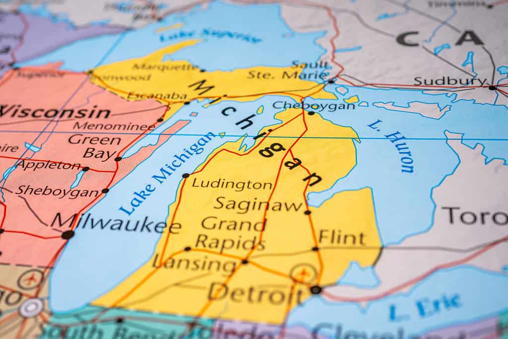
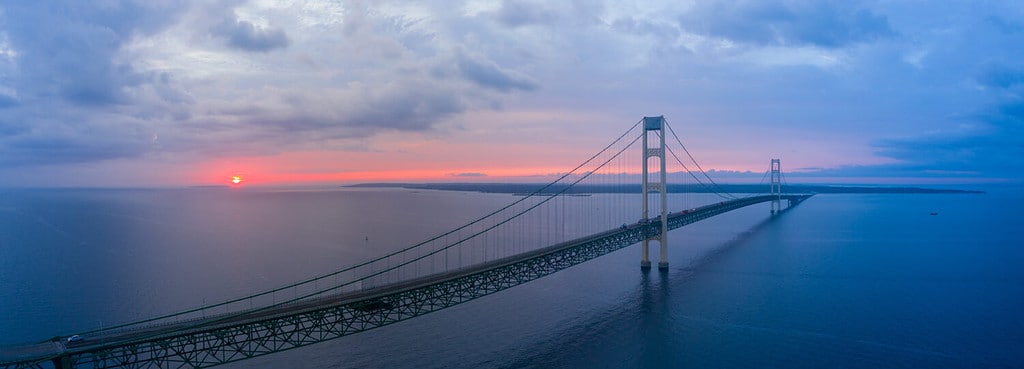
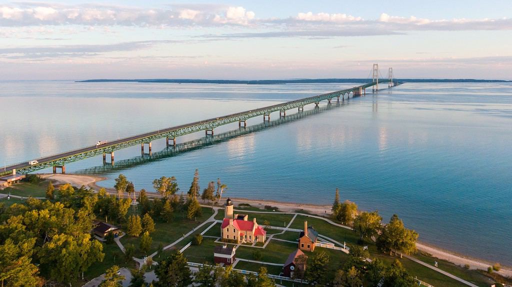
The most terrifying bridge inMichiganconnects the Lower Peninsula and Upper Peninsula and towers over the Straits of Mackinac, which connectsLake Michiganand Lake Huron. It’s 5 miles long and 155 feet above the water and often hosts winds of over 30 mph. This bridge is the Mackinac Bridge!
Where is the Mackinac Bridge?
Often thought to be one of the scariest bridges in the world, the Mackinac Bridge in Michigan goes from Mackinaw City in the Lower Peninsula to St. Ignace in the Upper Peninsula. The bridge is 155 feet above the water, with Lake Michigan on the west and Lake Huron on the east.
©Alexander Lukatskiy/Shutterstock.com
The Mackinac Bridge gets a lot of traffic as the primary way to get from the Lower Peninsula to the Upper Peninsula. If you’re coming to the UP from the Lower Peninsula, you’ll get on the bridge in Mackinaw City and wind up in St. Ignace. The only other way to drive to the Upper Peninsula from the Lower Peninsula is by going around the state and making your entrance through Wisconsin.
The Mackinac Bridge is on the “tip of the mitt,” at the most northerly spot on the Lower Peninsula. It connects the 5-mile gap between the two peninsulas. This is the closest location the Lower and Upper Peninsulas come to one another along the entire coast of the lakes, making it the perfect spot for a bridge.
History of Mackinac Bridge
In 1883, the Brooklyn Bridge opened for traffic. This bridge was an inspiration to people all over the world. Community members in St. Ignace, the town directly north of the Straits of Mackinac, began to dream of a connection between the Lower and Upper Peninsulas.
Before The Bridge
This dream made its way to the legislature in the mid-1880s, where it was discussed at great length. However, an official proposal wasn’t presented until 1888. Despite some support, little happened to implement the bridge for decades to come.
In the 1920s, discussion of the bridge came to light again, but the easier option seemed to be to establish a ferry service. In 1923, the legislature implemented a ferry service that served to transport individuals from the Lower Peninsula to the Upper Peninsula and vice versa. But the popularity of the ferry service boomed. Michigan needed to create a new way.
©EB Adventure Photography/Shutterstock.com
In 1928, the Governor of Michigan ordered an investigation into the feasibility of the bridge. Folks needed to be able to quickly move from the LP to the UP. The ferry service was expensive to run and the demand was outweighing the service’s ability to provide. Michigan made a bid for federal funding in the mid-1930s, but didn’t receive it.
While designs were debated, the lack of funding meant that the construction of the bridge had to wait. When World War II began, talks of construction totally stopped.
After World War II was finished, the dream of a bridge returned to conversations. Engineers finalized their designs in 1951, and the state legislature provided $85 million to construct the bridge on April 30, 1952. However, financial snags meant construction couldn’t start until a few years later.
Construction of the Bridge
David B. Steinman led the project as design engineer and construction began in 1954. The budget for the project was estimated to be around $95 million, and the bridge would be made into a toll road to help pay for the efforts.
©Steve Gadomski/Shutterstock.com
Construction was not a simple project. It took place over the span of 3.5 years and included the loss of five lives and costs of over $100 million. The bridge opened for traffic on November 1, 1957. The ferry service closed on this day, as well, honoring the new, more efficient way to make it to the Upper Peninsula.
How’d the Mackinac Bridge get its name?
As you may have noticed, the city of Mackinaw is spelled with a “w” at the end, while the bridge (and the famous Mackinac Island) are spelled with a “c” at the end.
The discrepancy in spelling is rooted in the original naming of the city, island, and bridge. Mackinac Island came first of the three. It was originally named Michilimackinac by Native Americans. Overtime, this was shortened to the name we recognize today: Mackinac. The meaning of the word michilimackinac is “great turtle.” The shape of the island and the rocks around the area made the island look like a turtle!
©Michael Deemer/Shutterstock.com
Mackinaw City wasn’t founded until the 1850s. The British founded the city and named it phonetically. Because “Mackinac” is pronounced the way that “Mackinaw” is spelled, the British chose the spelling that resembled the pronunciation.
The Mackinac Bridge, then, was named after the original spelling of Mackinac Island and Fort Mackinac. It can be a little confusing for tourists to understand the spelling differences, but the root of the difference is the origin of the area!
What’s special about Mackinac Bridge?
There are quite a few things that are special about the Mackinac Bridge. First and foremost, it is the fifth-longest suspension bridge in the entire world if measuring suspended length. It also weighs over 1 million tons and features over 40,000 miles of wire cable.
©iStock.com/Laurent Fady
How much does it cost to go over the Mackinac Bridge?
The toll to go over the Mackinac Bridge by car is $4.00 per standard vehicle. If you’re driving a tractor, trailer, bus, or motor home, the cost is $5 per axle. You can also grab a MacPass if you’re frequently crossing the bridge, which will allow you to prepay a card for faster entry.
Safety Precautions
The primary concern when crossing the Mackinac Bridge is the wind. Winds reach over 30 mph on the bridge regularly, making it a little bit of a spooky experience for some drivers. When the wind speed reaches 65 mph, the bridge closes due to safety concerns.
However, the Mackinac Bridge Authority offers a driver assistance program for drivers of cars and motorcycles who are wary of crossing the bridge. For just $10 a vehicle, plus the cost of the toll, a representative from the Authority will drive your vehicle across the bridge. These transport services help make the experience of crossing the bridge more accessible and simple for anxious drivers.
Nearby Activities
There are a lot of things to do near the Mackinac Bridge on both the Lower Peninsula and Upper Peninsula sides.
Lower Peninsula
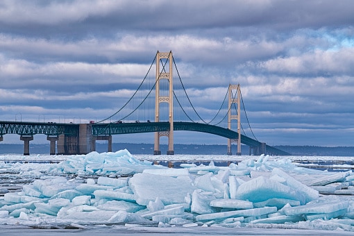
Mackinaw City is home to some awesome sights. Northern Michigan is a well-known spot to see blue ice. Slats of amazing ice with beautiful designs end up stacked on the shoreline of the Mitten. Mackinaw City is a great place to view this ice.
©dpenn/iStock via Getty Images
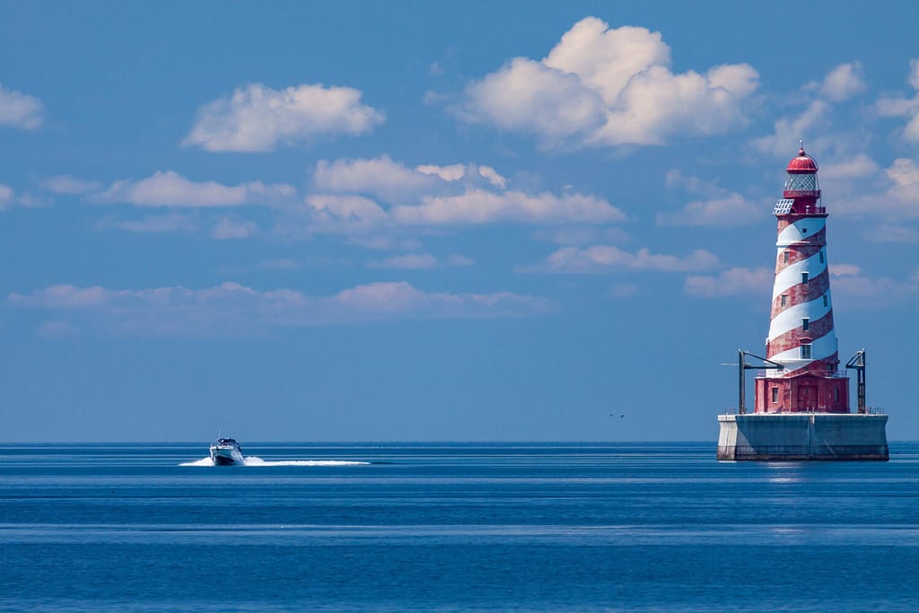
Mackinaw City also has several amazing lighthouses on the premises. The Old Mackinac Point Lighthouse and McGulpin Point Lighthouse are both in Mackinaw City, offering amazing opportunities to experience the history of Michigan. If you’re a lighthouse enthusiast, Michigan in general is a fantastic place to visit. While Mackinaw City is home to a couple of great lighthouses, the state as a whole has 129!
The Bridge is close to a few other great cities worth stopping by. Carp Lake is only a few miles south, and Wilderness State Park is just to the west of the city. Both of these areas offer fantastic sights in close proximity to the Upper Peninsula. If you’re into fishing or stargazing, these are must-see locations. They’re also both great spots for camping.
There isn’t too much wildlife nearby Mackinaw City, but keep your eyes out for adorable squirrels, chipmunks, and even a red fox now and then. Additionally, keep watch for black bears. While historically, most of the state’s black bears existed in just the Upper Peninsula, the species has been trickling down south. The Lower Peninsula has seen a 70% increase in black bears, so make sure you’re being careful. If camping in Michigan, be sure to keep bear spray on you.
Upper Peninsula
St. Ignace has several great stops to hit as you head north. Straits State Park and Bridge View Park are great opportunities to view the water from the Upper Peninsula. You can camp in St. Ignace or keep heading north.
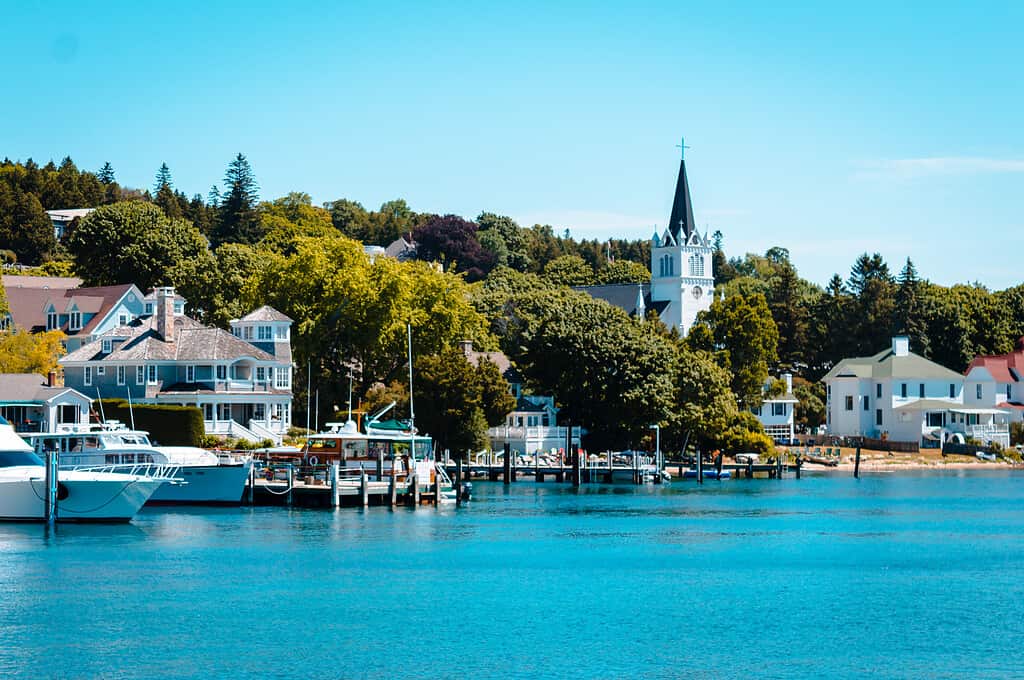
The most well-known stop near the Mackinac Bridge is Mackinac Island. Mackinac Island is a famous, no-vehicle island that is accessible by ferry. You can leave from St. Ignace or Mackinaw City and reach the island to experience restaurants, biking, and shops. Mackinac Island is also home to some awesome historic sites and parks. Spend the night at the famous Grand Hotel or just make a day trip to the island.
©iStock.com/Bywriter
Depending on where you land in the Upper Peninsula, there’s a broad variety of wildlife you might run into. Keep your eyes peeled for moose, cougars, and wolves, as well as the pesky black bears mentioned earlier. The Upper Peninsula sees a lot of wildlife that can cause harm to campers if not prepared, so make sure to do your research before camping in the northern part of the state. If you proceed safely, you can enjoy all the amazing animals that this part of the country has to offer.
How many bridges does Michigan have?
Michigan is home to 11,341 bridges. Because the state has the third most lakes in all of America (behind Alaska and Kansas), there’s a lot of need for these structures. Michigan is home to 64,000 lakes, all in all!
©John Brueske/Shutterstock.com
Of the 11,341 bridges that occupy the state, 1,292 of them are classified as deficient. This means there is a structural issue with one of the key areas of the bridge. 11.4% of the bridges in the state are deficient, which isn’t a great number. Thankfully, Mackinac Bridge is in good shape!
Conclusion
While the Mackinac Bridge might be a bit terrifying to cross, it’s absolutely worth it. With fantastic opportunities to explore on both sides of the bridge, you’ll have to cross it to experience all the magic that Michigan has to offer. Both the Upper and Lower Peninsulas have a wide variety of excursions for explorers, diners, bikers, campers, and more.