Discover the Largest Cities in Wyoming (By Population, Total Area, and Economic Impact)
Largest Cities in Wyoming by Total Area
Wyoming ranks as the 10th biggest state in the country. But unlike the state, its cities have relatively small land area.
| 1 | Casper | 26.9 |
| 2 | Cheyenne | 24.5 |
| 3 | Rock Springs | 19.3 |
| 4 | Gillette | 19 |
Casper
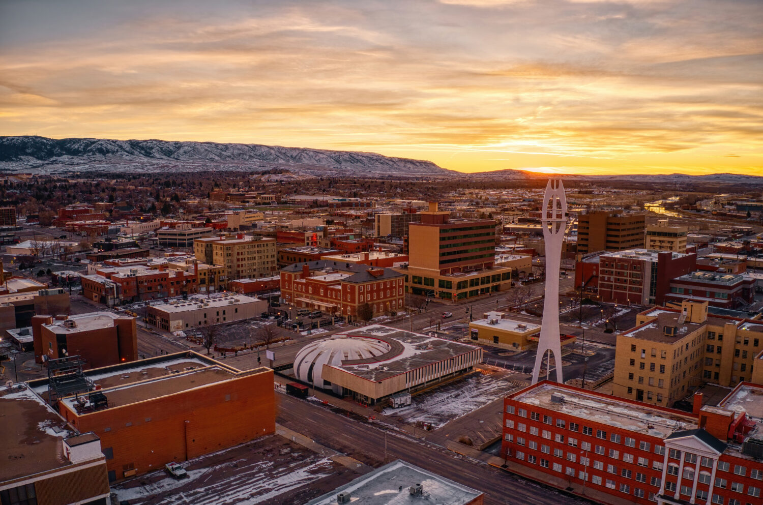
©Jacob Boomsma/Shutterstock.com
The town of Casper was established In June 1888.
Casper, the second-largest city by population, grabs the first place in total area with 26.9 square miles (69.7 square kilometers). The city is famous for its unique geographic features, climate, and notable natural attractions, making it a fascinating place to visit and live.
The city experiences a semi-arid climate with distinct seasons. Winters are cold and snowy, with average temperatures in the 20s and 30s °F (-6 to 2°C). Summers in Casper are warm and pleasant, with temperatures often reaching the 80s and 90s °F (27 to 37°C). Spring and fall offer crisp and cool weather, with highs in the 50s and 60s Fahrenheit (10 to 20°C). In the fall, the foliage in the area turns vibrant shades of red, orange, and yellow.
Natural Attractions
Casper is in the High Plains region of Wyoming, characterized by vast, open landscapes and rolling hills. The city’s location on the eastern edge of the Rocky Mountains gives it a unique blend of mountainous terrain and high desert plains.
Plus, the city is along the North Platte River, which flows through the city and adds to its scenic beauty. The river offers recreational opportunities such as fishing, kayaking, and rafting. Alcova Reservoir is a popular spot for boating, fishing, and camping.
Independence Rock is a historic landmark on the Oregon Trail located southwest of Casper. It’s a massive granite rock formation that pioneers used as a landmark on their westward journey during the 19th century.
South of the city, Casper Mountain provides a striking contrast to the surrounding plains. It offers outdoor enthusiasts a range of activities, including hiking, mountain biking, and skiing in the winter months. For skiing enthusiasts, Hogadon Basin Ski Area on Casper Mountain offers skiing and snowboarding during the winter months.
Cheyenne
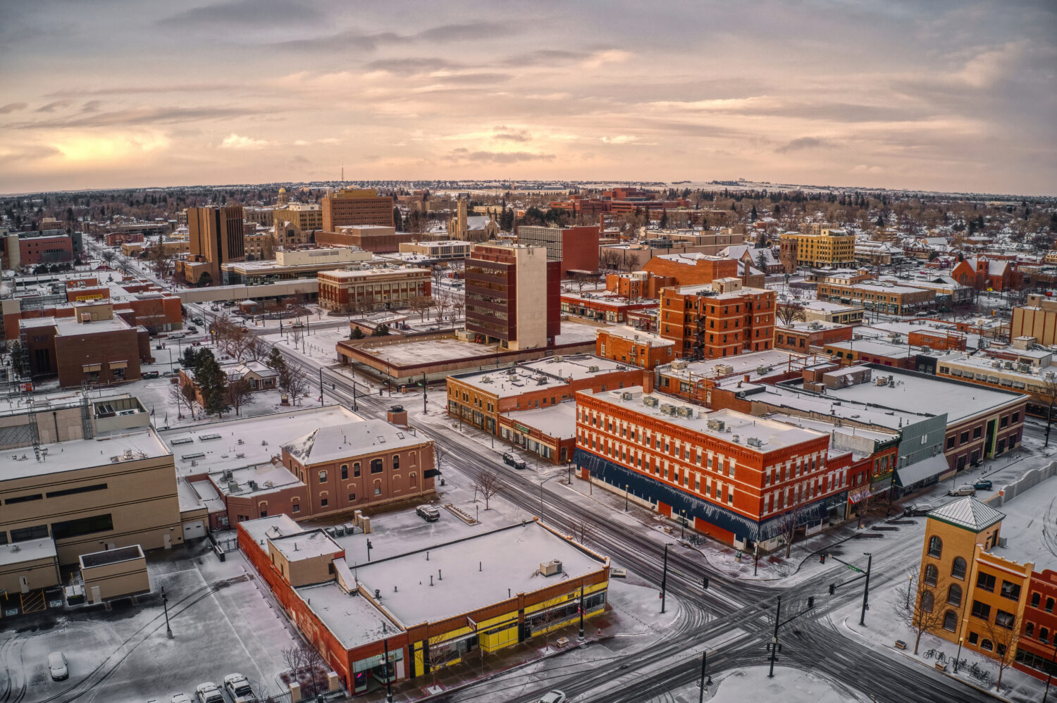
©Jacob Boomsma/Shutterstock.com
The city’s elevation is approximately 6,062 feet (1,848 meters) above sea level. It is one of the highest state capitals in the United States.
With 24.5 square miles of total area (63.5 square kilometers), Cheyenne falls short behind Casper. The city has a rich history, vibrant culture, a unique blend of urban amenities, and Wyoming’s natural beauty.
Winters in Cheyenne are cold and dry, with temperatures often dropping below freezing. Snowfall is expected during winter, and the city enjoys a picturesque snowy landscape. Summers are relatively warm with low humidity. Average high temperatures in the summer months range from the 70s to the 80s °F (around 21-32°C). Spring and fall offer milder and more temperate weather.
Natural Attractions
While Cheyenne is not known for its natural attractions, it is a gateway to many of Wyoming’s stunning outdoor destinations.
Located 30 miles (48.3 kilometers) west of Cheyenne, Curt Gowdy State Park, this state park offers hiking, mountain biking, fishing, and water recreation on the park’s reservoirs. Also west of Cheyenne, the Medicine Bow National Forest is a stunning area offering a range of outdoor activities, including hiking, camping, fishing, and wildlife viewing.
East of Laramie, a short drive from Cheyenne, Vedauwoo Recreation Area is renowned for its unique rock formations, making it a popular spot for rock climbing and hiking.
If willing to do a two-hour drive, northwest of Cheyenne is the Laramie Peak, the highest peak in the Laramie Range. It also offers hiking and breathtaking panoramic views from its summit.
In Cheyenne, visitors can enjoy a rich cultural scene, including historic sites, museums, and annual events like Cheyenne Frontier Days, the world’s largest outdoor rodeo and western celebration.
Rock Springs
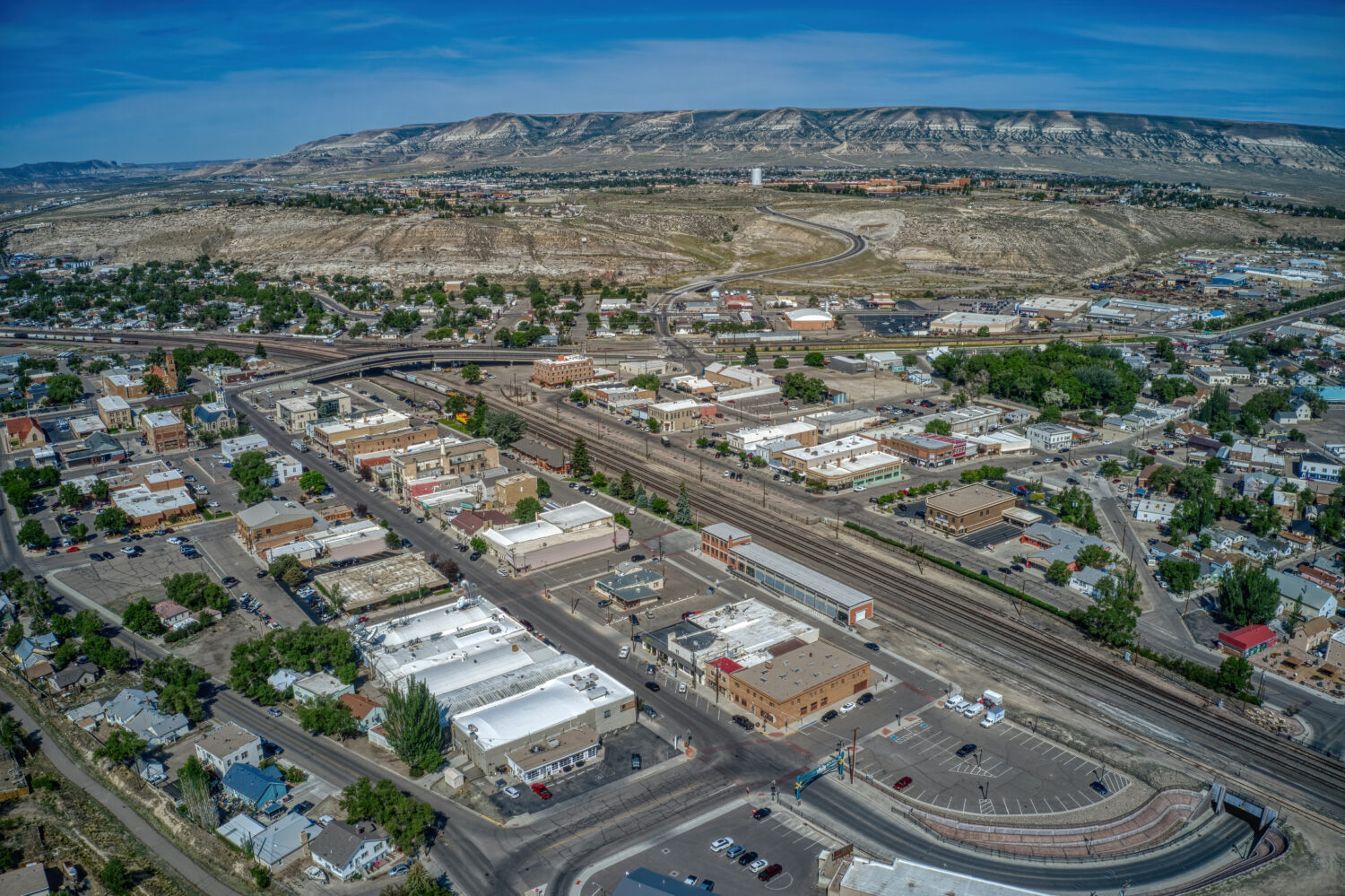
©Jacob Boomsma/Shutterstock.com
Rock Springs, with 19.3 square miles (50 square kilometers), is in the southwestern part of the state. The city is in the high desert region of Wyoming. Vast expanses of sagebrush and arid terrain characterize the surrounding landscape. But it is also along the banks of the Green River. The desert environment contrasts with the lushness of the Green River Valley, creating a diverse and picturesque setting.
Winters in Rock Springs are cold and snowy. Average temperatures often drop below freezing, and snowfall can be significant. Summers are warm and dry, with average high temperatures in the 80s and 90s °C (around 27-37°C). The region enjoys plenty of sunshine during summer, making it an ideal time for outdoor activities. Spring and fall bring milder temperatures, and the changing foliage in the nearby mountains is particularly striking during the fall.
Natural Attractions
The Green River offers recreational opportunities like fishing, boating, and rafting. It is also famous for its scenic beauty as it meanders through the rugged terrain of western Wyoming.
The Seedskadee National Wildlife Refuge, located along the Green River, is a haven for wildlife enthusiasts. It provides habitat for various bird species, including waterfowl and raptors.
Located near Rock Springs, the Flaming Gorge National Recreation Area is a stunning reservoir surrounded by red-rock canyons. It offers opportunities for boating, fishing, camping, and hiking. The vibrant colors of the gorge, especially at sunset, are a stunning sight.
West of Rock Springs, the Killpecker Sand Dunes cover an extensive area. These dunes are popular destinations for off-roading and sandboarding.
Gillette
©John D Sirlin/Shutterstock.com
Gillette and its 19 square miles (49.2 square kilometers) is Wyoming’s fourth-largest city by total area. Located in the Powder River Basin, a large sedimentary basin with extensive coal deposits. The city is surrounded by rolling prairies and is also part of the High Plains region of the United States.
While open plains and gently rolling hills predominantly characterize the area around Gillette, the presence of the Powder River Basin played a significant role in the local economy, as it contains valuable coal reserves.
The city experiences a semi-arid climate with distinct seasonal variations. Winters in Gillette are cold and can be pretty harsh. Sub-freezing temperatures and snowfall are expected during the winter months. Summers are generally warm and pleasant. Daytime temperatures in the summer months can range from the 70s to the 90s °F (20s to 30s °C). Gillette receives relatively low annual precipitation, typical of many areas in the High Plains. In summer, occasional thunderstorms can happen.
Natural Attractions
Located 35 miles (56.3 kilometers) southwest of Gillette, Keyhole State Park offers a picturesque reservoir surrounded by red sandstone cliffs. It’s a popular spot for boating, fishing, camping, and wildlife viewing.
Although not in Gillette, Devil’s Tower is a unique geological formation about a two-hour drive to the northeast. It’s a prominent igneous rock column rising dramatically from the surrounding landscape and is a popular destination for climbers and sightseers.
Visitors will also find the scenic Black Hills of South Dakota just east of Gillette. This area boasts beautiful forests, hiking trails, and attractions like Mount Rushmore and Custer State Park, making it an excellent destination for day trips.
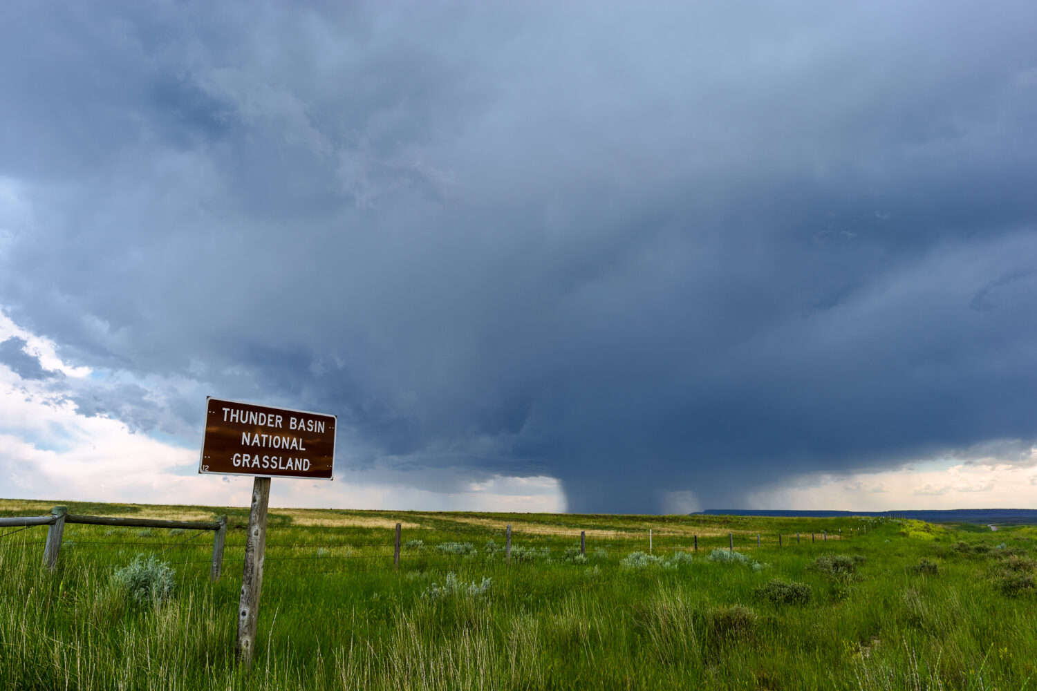
Close to Gillette is Thunder Basin National Grassland. This vast area of protected grasslands covers approximately 547,499 acres in northeastern Wyoming. This extensive grassland ecosystem has a unique blend of rolling prairies, sagebrush steppe, and a variety of wildlife habitats. Visitors can explore through scenic drives like the Backcountry Byway and Red Hills Road.
The grassland provides essential habitat for many wildlife species, including pronghorn antelope, mule deer, elk, coyotes, eagles, and numerous bird species. But the area also offers opportunities for outdoor activities such as hiking, birdwatching, wildlife photography, and camping. The site has several designated campgrounds and picnic areas where visitors can enjoy the natural beauty of the grassland