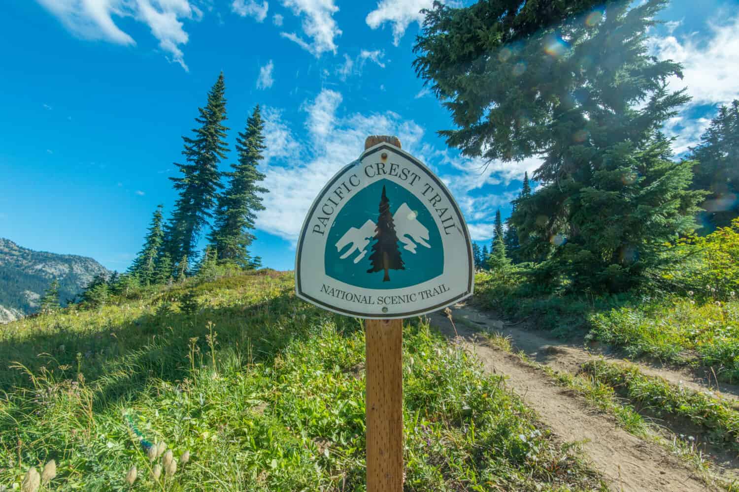
Pacific Crest Trail in Washington: 7 Facts You Didn’t Know
The Pacific Crest Trail (PCT) is an iconic long-distance hiking trail. It extends from California’s southern border with Mexico to Washington’s northern border with Canada. Stretching for approximately 2,650 miles (4,265 kilometers), this epic trail takes hikers on a remarkable journey through deserts, forests, mountains, and alpine regions.
Discover some facts about the Pacific Crest Trail in Washington.
1. Washington Is the Start and the End of the Trail
©Modern Meta Photography/Shutterstock.com
The Pacific Crest Trail officially begins or ends, depending on the hikers’ direction in Washington at the northern terminus. This area, called Hart’s Pass, is just a few miles south of the Canadian border. Arriving near the border with Canada is symbolic, especially for northbound hikers, as they started the PCT at the United States-Mexico border.
Hart’s Pass has a small trailhead with a parking area and a restroom facility. This is the first or last place where hikers can rest, regroup, and prepare for their hike ahead or their return home. The northbound hikers who end the trail at Hart’s Pass often celebrate completing this iconic hike with traditions like signing a trail register or leaving a commemorative item. Sometimes, thru-hikers even leave their hiking boots behind!
After Hart’s Pass, the trail continues and crosses into Canada. This is a 60-mile (97-kilometer) out-and-back hike to the unofficial end of the path. The area is extremely remote, with no vehicle access. This is why Hart’s Pass is the official end and start of the Pacific Crest Trail.
Hart’s Pass is one of the highest points along the entire trail. It sits at an elevation of approximately 6,000 feet (1,829 meters) above sea level. This elevation adds to the challenge of reaching the terminus. Hikers must ascend from lower elevations to reach this point.
The area also offers stunning mountain vistas. Hikers are rewarded with breathtaking panoramic views of the surrounding North Cascade Mountains. Plus, they can encounter marmots, mountain goats, and other alpine creatures in this region.
2. Hikers Will Have to Go Through the Hardest Parts of the Cascade Range
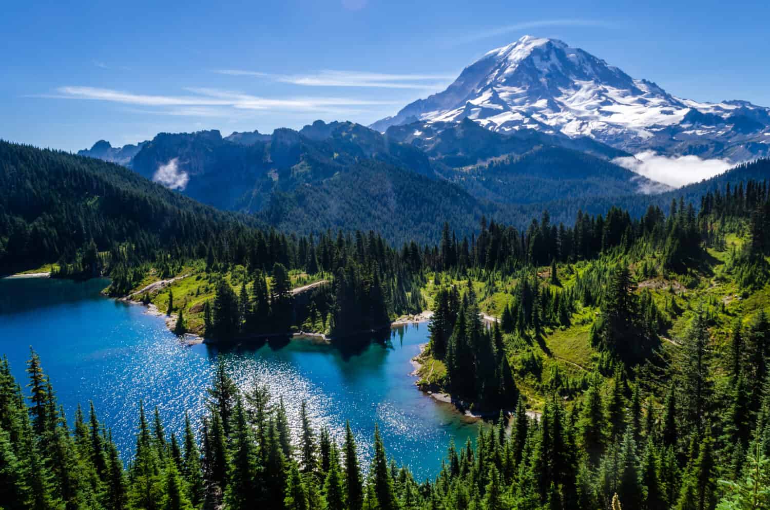
©KYPhua/Shutterstock.com
The Cascade Range is an extensive mountain range in the Pacific Northwest region of North America. It extends over two countries, from British Columbia, Canada, through the U.S. states of Washington and Oregon, and into northern California. The Washington portion of the Cascade Range has stunning sceneries and diverse ecosystems. As the end and the start terminus, it also plays a significant role in the Pacific Crest Trail (PCT).
If the Cascade Range in Washington is beautiful, it is also one of the most challenging and tough sections of the trail. Hikers will explore the Cascade Range’s alpine meadows, dense forests, and high mountain passes. When approaching the Cascade Range portions, hikers must have careful and precise planning and navigation, especially during the snowmelt season.
The Cascade Range is also home to one of the most stunning mountains in the United States, Mount Rainier. This active stratovolcano stands as the highest peak in the state, with an elevation of 14,411 feet (4,392 meters). It is famous for its stunning views and glaciated slopes.
Additionally, the northern part of the Washington Cascade Range is home to North Cascades National Park. With its rugged terrain, pristine wilderness, and numerous glaciers, this national park offers tough and remote sections of the PCT.
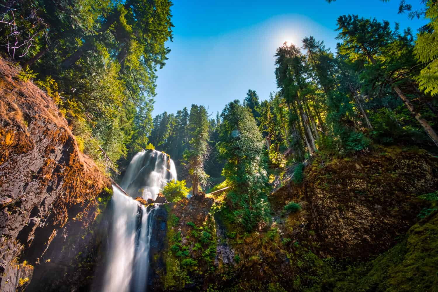
3. Hikers Will See the Alpine Lakes Wilderness
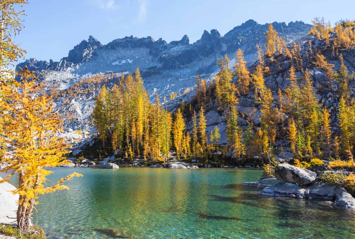
©Galyna Andrushko/Shutterstock.com
The Alpine Lakes Wilderness is a stunning and ecologically diverse region in the central Cascade Range of Washington state. It is one of the most iconic and pristine wilderness areas that the Pacific Crest Trail crosses in Washington.
This wilderness is famous for its stunning natural beauty, with jagged peaks, high alpine lakes, cascading waterfalls, lush forests, and meadows filled with wildflowers. The scenery makes it a favorite among PCT hikers and backpackers.
True to its name, the area also has numerous alpine lakes. These crystal-clear lakes offer ideal camping spots and opportunities for refreshing swims after a long day of hiking. Must-see lakes include Colchuck Lake, Lake Valhalla, and Snow Lake.
The Alpine Lakes Wilderness is home to a diverse range of wildlife. Hikers may encounter marmots, pikas, mountain goats, deer, and even the elusive black bear. Birdwatchers can spot avian species, including eagles, hawks, and songbirds.
In addition to the PCT, the area also features an extensive network of hiking trails. These can be great day trips for hikers as most lead to pristine lakes, waterfalls, and viewpoints. However, it is a challenging area, especially when snow is present. Hikers should always be prepared with precise navigation and also proper gear. If thru-hikers want to stay overnight or explore specific trailheads, they must acquire a permit.
Efforts to protect the Alpine Lakes Wilderness have been ongoing for decades, thanks to the work of conservation organizations and agencies. These work together to preserve this wilderness area’s natural beauty and ecological integrity for future generations of outdoor enthusiasts.
4. Hikers Will Go Across the Goat Rocks Wilderness
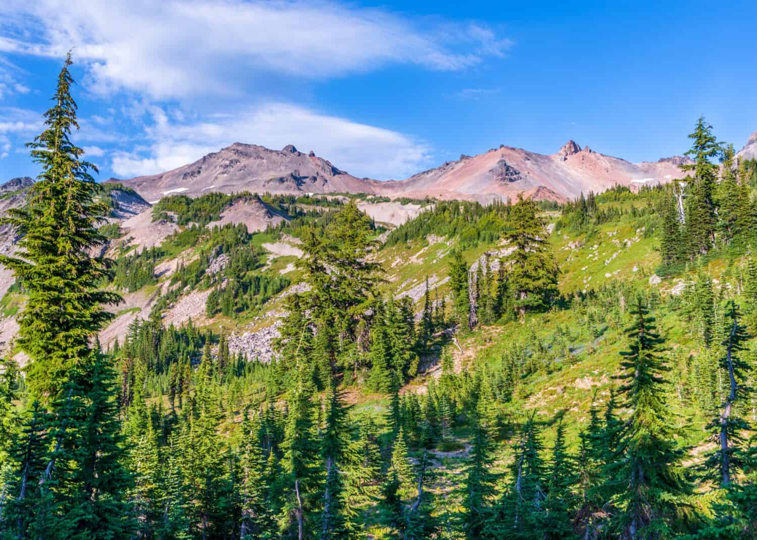
©J-B-C/Shutterstock.com
Goat Rocks Wilderness is a spectacular and unique section of the Pacific Crest Trail in Washington. It offers panoramic views of snow-capped peaks, alpine meadows, and lush valleys.
Hikers will come across stunning vistas of towering volcanic peaks, including Mount Rainier and Mount Adams. But the area also has several high-altitude mountain passes. One of the most famous is Knife’s Edge, a narrow ridge that provides 360-degree views. However, this area is very tough for hikers and can be challenging due to its exposed nature.
The area has numerous pristine alpine lakes, offering stunning scenery to the Pacific Crest Trail hikers. These lakes are ideal for cooling off, fishing, or enjoying serene surroundings. During the summer months, the meadows in Goat Rocks Wilderness burst into vibrant displays of wildflowers. These include lupines, Indian paintbrushes, and others.
As the name suggests, Goat Rocks Wilderness is home to many mountain goats. Hikers may be able to spot these impressive creatures as they traverse the rocky terrain. This species displays incredible skills when crossing and climbing incredibly steep areas. However, it’s important to remember that they are wild animals and should be observed from a safe distance.
In addition to mountain goats, the wilderness area is home to various other wildlife species. Visitors may encounter marmots, pikas, deer, and even the occasional black bear.
5. Hikers Will Explore the Gifford Pinchot National Forest
©Stephen Moehle/Shutterstock.com
Gifford Pinchot National Forest is a stunning forest and picturesque portion of the Pacific Crest Trail (PCT) in Washington. Named after Gifford Pinchot, the first Chief of the U.S. Forest Service, this forest covers approximately 1.3 million acres of land.
As the PCT passes through Gifford Pinchot National Forest, the trail takes hikers through a range of diverse landscapes. Hikers will observe a stunning forest filled with towering Douglas fir and western red cedar trees, lush meadows, high alpine environments, and rugged mountain terrain.
The Pacific Crest Trail within the forest can be divided into several notable sections.
- Indian Heaven Wilderness: This section of the trail is famous for its volcanic landscapes, with multiple small lakes formed in ancient lava flows. It’s a popular area for camping and fishing.
- Trout Lake: Hikers pass through the charming town of Trout Lake. This town is an important resupply point before hikers go back to more remote areas.
- Mount Adams: The PCT winds around the southern slopes of Mount Adams, Washington’s second-highest peak. The mountain is a prominent landmark and offers stunning views for hikers.
Hikers going through the Gifford Pinchot National Forest will hike in different ecosystems. This diversity of habitats supports a wide array of plant and animal species. Visitors can encounter elk, deer, black bears, and various bird species, including bald eagles and ospreys. The forest also provides crucial habitat for threatened and endangered species like the northern spotted owl and fisher.
The national forest also contains historical sites such as fire lookouts, which were once vital for detecting and managing wildfires. Some of these lookouts have been preserved and can be visited by hikers. Additionally, hikers can stop and explore visitor centers to learn more about the forest ecosystems and management.
6. Hikers Need to Cross the Bridge of the Gods to Complete the Hike
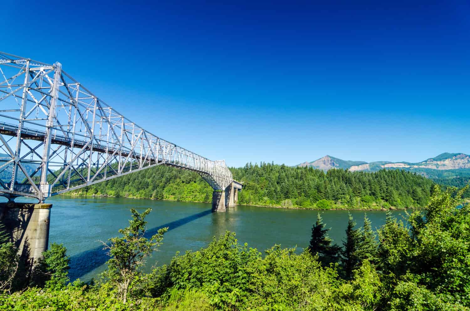
©Jess Kraft/Shutterstock.com
The Bridge of the Gods, completed in 1926, is an iconic feature along the Pacific Crest Trail. It crosses the Columbia River, marking the border between the states of Washington and Oregon.
Key Facts
- The Bridge of the Gods is located near Cascade Locks, Oregon, and connects to Stevenson in Washington.
- This impressive steel truss cantilever bridge crosses the Columbia River. This river is the largest in the Pacific Northwest region of the United States.
- According to local tribes, a natural land bridge existed before. Then, a massive landslide happened and created the geological formation that the Bridge of the Gods now crosses.
For PCT thru-hikers, this bridge is a memorable milestone. Depending on their direction, it marks either the end or the beginning of their journey through the state of Washington. The bridge is about 1,856 feet (566 meters) long and offers stunning views of the Columbia River and its lush surroundings. Some hikers sometimes take photos to remember the crossing between the two states. Especially for northbound hikers, as Washington is the last state they will hike the PCT in.
However, hikers and pedestrians must be very cautious when crossing the bridge. There are no sidewalks, so they have to walk along vehicle traffic. The bridge is free to cross when walking.
Once in Washington, Stevenson is an important resupply point for PCT hikers. It offers accommodations, restaurants, and stores where hikers can restock their supplies. Hikers can take a break from the trail and relax along the river banks.
7. Hikers Will Come Across Many Cultural Sites
©Amehime/Shutterstock.com
Along the Pacific Crest Trail in Washington, hikers will come across various cultural sites. These provide insights into the region’s rich history and heritage.
Washington is home to several Native American tribes, including the Yakama Nation, Colville Confederated Tribes, and others. Native Americans have used the area along the Pacific Crest Trail as a gathering place for ceremonies, trade, and cultural events. These sites can include petroglyphs, pictographs, and ancient trail routes used by indigenous people.
Also, a sight unique to PCT in Washington is its many historic fire lookout towers. These structures were once vital for spotting and monitoring wildfires. Some of them have been preserved and are open to the public. Washington also has a rich logging history. Remnants of this industry are along the Pacific Crest Trail, where hikers can observe old logging roads, equipment, and even abandoned logging camps.
Additionally, hikers will pass through or near several trail towns, such as Stehekin, Trout Lake, and Skykomish, where they can stop for a side day trip. Hikers can explore the historical buildings, museums, and visitor centers where hikers can learn about the local history and culture.


