How Deep Is California’s Eel River?
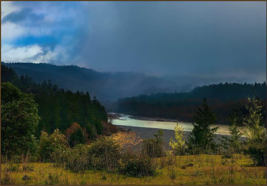
If you take a drive through the Mendocino National Forest, you have the opportunity to see the massive Eel River that flows through. As it traverses mountainous areas, redwood forests, and canyons, it offers one of the most beautiful landscapes of Northern California. As the third-largest watershed in the state, it drains 3,500 square miles.
The flow of this river varies greatly with changing storm patterns from the Pacific, but the main segment still stretches nearly 200 miles long. Since it is a major water source, it connects to the Van Duzen River, North Fork, Middle Fork, and South Fork. These tributaries benefit greatly from this relationship, supporting local agriculture and municipal water supply.
Let’s take a look at the changing depth and history of California’s Eel River.
The History of the Eel River
©Creative Commons – License
Before the Eel River became the site of European settlements, the lands surrounding it were home to a few Athabaskan Indian tribes. These tribes included the Wailaki, Nongatl, Sinkyone, and Wailaki peoples. When settlers first arrived along the river, they used the redwoods that grew along the river to offer timber as a trade with locals.
Even though with a limited population among these tribes, the surrounding region didn’t have much traffic from others until 1850 and later. While much of California worked to attract new settlers with the promise of gold, the fertile soil near the river offered even greater appeal. Settlers inhabited the area comfortably by the end of the 19th century, naming one of the branches of the river after James Van Duzen from their expedition.
At the start of the 20th century, local officials decided to establish several dams along the river to direct more water to Sonoma County and Mendocino County. When they initially installed the dams, locals wanted to make them bigger for the State Water Project. However, the majority of proposals submitted lacked economic purpose and posed a significant threat to the otherwise booming salmon population.
By 1981, the government named this body of water a Wild and Scenic River, which prevents new dams from being added. Even with this restriction, local activities like logging and cannabis harvesting influence the overall climate of the river.
Why Is It Called “Eel River” If It Doesn’t Have Eels?
A common misconception to tourists about the Eel River is that the name comes from the plethora of eels, but that’s not the case at all. Eel River doesn’t have a single eel. The majority of the aquatic life in this river consists of salmon and steelhead.
©David A Litman/Shutterstock.com
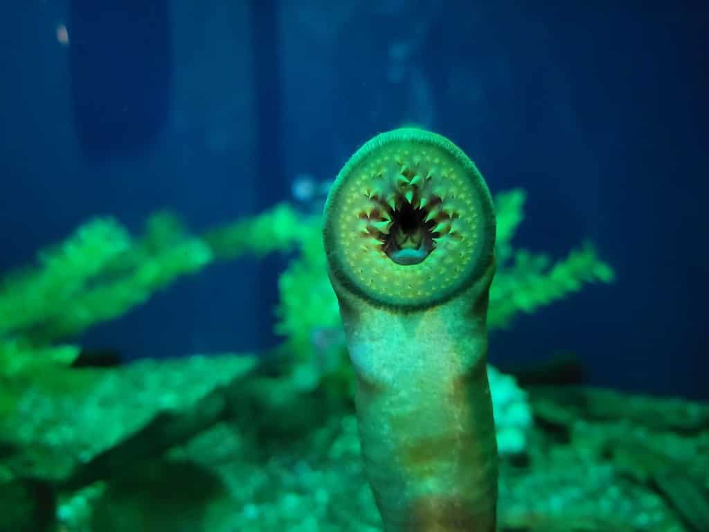
The main reason that this body of water is named Eel River is due to the wrongful identification of eel-like fish in the river – the Pacific lamprey and the green sturgeon. European settlers named the river after this wrongful assumption, but the name stuck. Lamprey has an eel-like appearance with their long and slender body, and they are one of the most common species in the river.
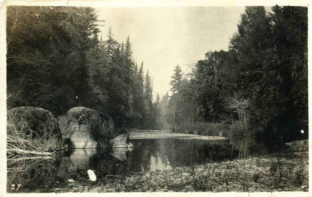
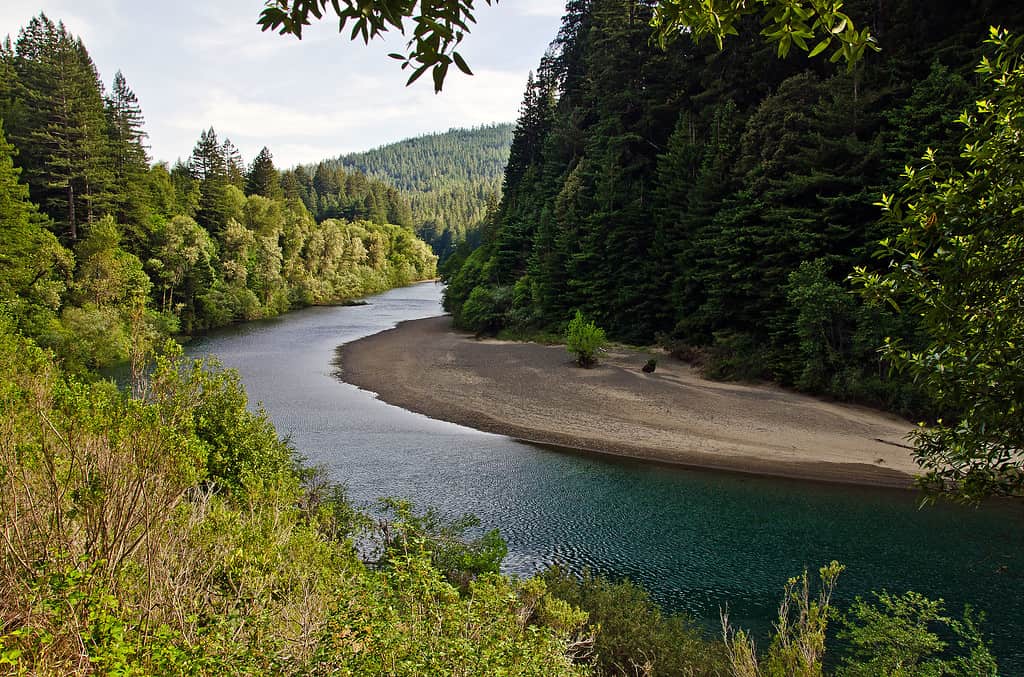
Depth of Eel River
Sitting at a 2,500-foot elevation, Eel River isn’t necessarily known for its depth. With instability in its geological structure and constant exposure to storms from the Pacific, this river system has a reputation for constant change. Since it meets the Pacific Ocean at the end of its watershed, any storms that affect the ocean will have a ripple effect on the river. While the weather during the winter months encourages average flow, it varies substantially at the end of summer and fall.
©Creative Commons – License
This part of California often endures a lot of landslides, causing suspended sediment that alters the underwater landscape and depth. With the constant influence of storms and other factors, depth changes by the day. The National Weather Service currently offers a prediction website to indicate the changes in depth, which varies from day to day.
Ecology of Eel River
Wildlife
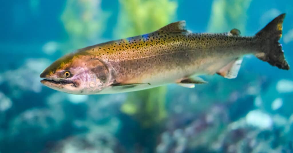
In Eel River, steelhead, chinook salmon, and lamprey are the most abundant of all the fish species. Both the summer and winter variations of the steelhead are at risk, but the California coastal chinook is one of the most popular salmonoid fish to find in the river. They live for 3+ years, and the Federal ESA lists them as threatened, just like the northern California steelhead.
Both southern Oregon and northern California varieties of coho are in the river, but they need conservation support to increase the population. Like the chinook and steelhead fish, it currently falls under the Threatened status with the Federal ESA. The biggest population of coho salmon is in the South Fork, but they live throughout the various tributaries.
©Avdey/Shutterstock.com
The oldest fish species found in the Eel River is Pacific lamprey, offering 20% more protein than what locals get from salmon. Though their species dates back 360 million years, they mostly stayed the same. If the river doesn’t maintain its Pacific lamprey population, salmon populations drop as well because the former is its primary food source.
Green sturgeon are the only other common species throughout the river, but the dynamic landscape on the river’s floor doesn’t have the same deep pools anymore. Instead, flooding and sediment limit the habitat for these fish, but local officials have no efforts to protect them at this time.
Plant Life
Even with the landslide that threatens the river’s rising sediment levels, the nutrients in adjacent land offer enough nutrients to grow the tallest redwood groves in the state. These redwoods are a major source of lumber, just like the western hemlock along the river.
©Creative Commons – License
As beautiful as the local trees are, make sure to keep an eye out for poison oak. This dangerous plant causes severe itching and pain if you touch it, and it grows along many trees in the area. Still, if you stay away from this risk, you get to simply enjoy the local Douglas firs in the area as well.
Within the river, the climate changes and excessively high nitrogen and phosphorous provide the ideal breeding ground for algal blooms. These growths thrive with high temperatures, new organic matter, and a high pH, according to the California Water Quality Monitoring Council.
What To Do Along Eel River
©Creative Commons – License
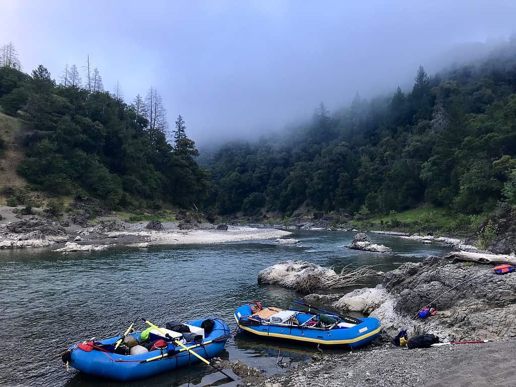
With four separate forks, finding a variety of recreational activities to try along Eel River is easy. Each tributary provides a unique view of California, inviting visitors to come and see the natural beauty. If you enjoy water activities like swimming, fishing, or boating, the South Fork and the Main Stem have a combined 30 miles of water flow to use. During the summer, taking the path from Alderpoint to Eel Rock is both gentle and comfortable, especially with an innertube. Since much of the South Fork’s water depends on local rainfall, be aware of any forecasted changes in weather to avoid dangerous storms.
If you want to participate in land activities along Eel River, there’s a 12-mile stretch to hike or run that takes you between the Scott and Van Arsdale dams. There’s also a run from Dos Rios to Alderpoint for experienced hikers, taking nearly 4 days to complete. For some people, the journey takes longer because the Eel River offers rich and lush scenery along its banks. Since the winds get more active in the afternoon, plan any of your hike’s water activities for the morning or early afternoon.
As long as you check local flooding risks, the beaches that border Eel River offer the perfect spot to camp. The Eel River Campground, located in Covelo, offers 15 separate sites to spend the night.
Where is Eel River Located On A Map?
With the lack of preservation, the Eel River is currently one of the most endangered rivers in the country, stretching 196 miles. It starts at the southern end of Bald Mountain in the Mendocino National Forest. It flows into Lake Pillsbury, which is the result of the installation of Scott Dam. The Cape Horn Dam directs water to the East Fork Russian River.
The river then reaches the rest of Mendocino County to follow the westward flow. Below the Cape Horn Dam, the river goes north, which is unusual for this area. After a 20-mile journey downstream, the North Fork Eel River meets the Middle Fork, cutting across Humboldt County and joining the South Fork. It ultimately ends at the Pacific Ocean.
How Does Eel River Measure Up Against Other California Rivers?
While the Eel River stretches 196 miles across California’s land, it only ranks as the 6th longest system in the state. It is also the third-longest river to be wholly located in California, rather than crossing into other states. Take a look at how this river measures up against the rest, starting with the longest.
- Colorado River: 1,450 miles
- Sacramento River: 447 miles
- San Joaquin River: 365 miles
- Klamath River: 263 miles
- Pit River: 207 miles
- Amargosa River: 185 miles
- Owens River: 183 miles
- Salinas River: 170 miles
- Trinity River: 165 miles


