The 6 Most Stunningly Scenic Drives in British Columbia
Nestled in Western Canada, British Columbia is a province famous for its breathtaking natural beauty. With coastal rainforests, towering mountain ranges, pristine lakes, and rugged coastlines, British Columbia offers stunning sceneries. One of the best ways to experience this province’s landscapes is by hopping on its scenic drives.
Let’s explore the picturesque routes and hidden gems of British Columbia.
1. Sea-to-Sky Highway
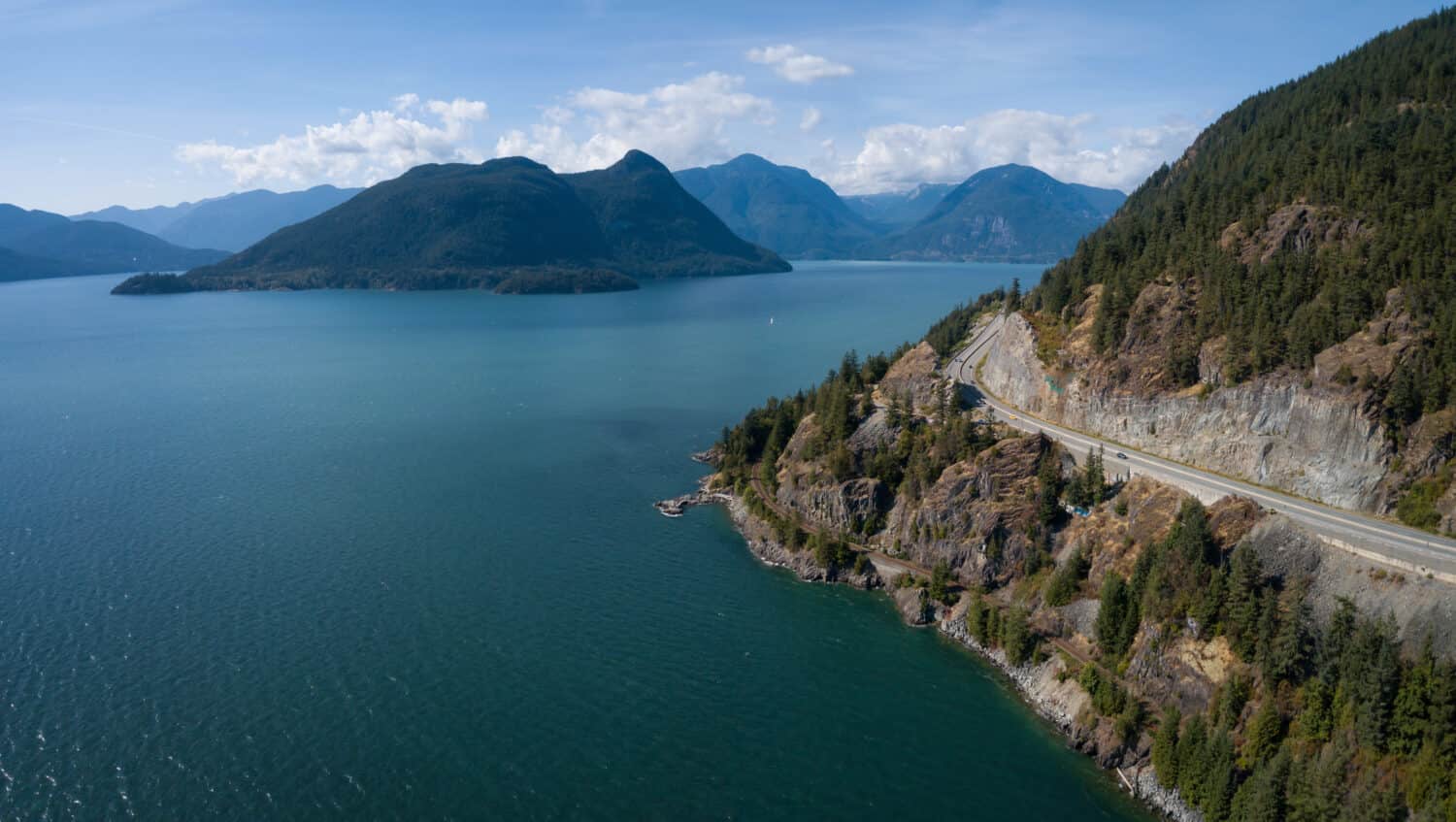
©EB Adventure Photography/Shutterstock.com
The Sea-to-Sky is one of the most stunning drives in North America. This road extends from Vancouver to Pemberton, just north of Whistler. Also known as Highway 99, this iconic drive in British Columbia extends to approximately 101 miles (163 kilometers).
The Sea-to-Sky Highway begins in the bustling city of Vancouver, specifically at the intersection of West Georgia Street and Seymour Street in downtown Vancouver. Visitors will then embark on a journey through some of the region’s most picturesque landscapes.
Highway 99 offers a constantly changing landscape. It begins with the urban setting of Vancouver and transitions into lush coastal rainforests, fjords, rocky cliffs, and the towering peaks of the Coast Mountains. Along the way, visitors can observe the stunning vistas of Howe Sound, Bowen Island, and the Tantalus Range.
Wildlife encounters are also possible on this route. There are opportunities to spot bald eagles, black bears, deer, seals, and, if you’re lucky, even whales in the waters of Howe Sound.
Vancouver
Before officially beginning your Sea-to-Sky adventure, consider visiting Stanley Park, a famous urban park in Vancouver, one-fifth bigger than Central Park in New York! It offers scenic views of the city skyline, the Lion’s Gate Bridge, and Burrard Inlet.
Visitors can also explore Vancouver’s history by visiting the city’s birthplace in Gastown or stroll into Chinatown. To start on the Sea-to-Sky Highway, you must cross the Lions Gate Bridge to reach North Vancouver and West Vancouver.
North and West Vancouver
In North Vancouver, visitors can discover the thrilling Capilano Suspension Bridge, which swings 450 feet (135 meters) above ground. After the visit, head to Lighthouse and Whytecliff Parks in West Vancouver for stunning views of Howe Sound and the Georgia Strait.
Horseshoe Bay
Horseshoe Bay is a must-stop on Highway 99. The charming village offers a small harbor, crispy fish and chips, and serene bay views. Visitors can watch ferries sailing into port, stroll along the marina, enjoy a waterfront playground, and taste delicious seafood.
Porteau Cove Provincial Park
North of Horseshoe Bay is Porteau Cove Provincial Park, a perfect spot for scuba diving. Artificial shipwrecks and reefs support various marine life species, such as lingcod, octopus, and starfish. And if you are not a fan of scuba diving, you can always explore the rocky beach or take a refreshing dip in the ocean.
Britannia Beach
Britannia Beach is a great spot to learn more about the region’s history. Visitors can explore the Britannia Mine Museum National Historic Site and learn about the history of the mine and the area. The region was once home to the largest copper-producing mine in the British Commonwealth. Multiple activities are available in the museum. Visitors can pan for gold, observe historic mining equipment, and even board a mining train to travel deep into an old mining tunnel.
Sea-to-Sky Gondola
North of Britannia Beach is the Sea-to-Sky Gondola. Catch a ride to the top and enjoy stunning views of the surrounding mountains and ocean. Visitors can explore a suspension bridge and try to take on the via ferrata!
Squamish
If you like outdoor activities, then Squamish is a must-stop for you! Also called the “Outdoor Recreation Capital of Canada,” it is an outdoor enthusiast’s haven. The area has more than 600 mountain biking trails weaving through old-growth forests. Hiking trails are also available, and visitors can embark on a rafting tour!
Whistler
The journey ends in the beautiful town of Whistler, once home of the Winter Olympics. This famous resort town is ideal for hiking and mountain biking in the summer and skiing and snowboarding in the winter.
2. Pacific Marine Circle Route
©canadastock/Shutterstock.com
The Pacific Marine Circle Route is a scenic road trip that explores the southern regions of Vancouver Island. Starting and ending in Victoria, the provincial capital, this approximately 185-mile (298-kilometer) loop takes visitors through various landscapes. It offers opportunities to experience the island’s rich natural beauty, history, and culture.
The route offers panoramic views of the Juan de Fuca, Haro, Georgia Straits, and the Saanich Peninsula. Visitors will encounter diverse landscapes, including lush rainforests, rugged coastlines, serene lakes, and picturesque farmland. Keep an eye out for diverse wildlife, such as bald eagles, seals, sea lions, and even orcas! Additionally, the rainforests along the route are home to various bird species, and you may spot deer or black bears in more remote areas.
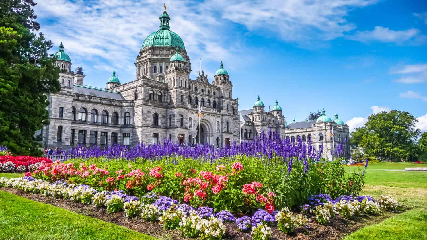
Victoria
The drive begins in Victoria, where visitors can explore the picturesque Inner Harbour, the Royal BC Museum, and the Parliament Buildings. The city is famous for its beautiful gardens, so it is almost a must-do to go take a stroll through the stunning Butchart Gardens.
Sooke
After leaving Victoria, the road takes you through the charming seaside town of Sooke. Visitors can enjoy craft breweries or the Sooke Region Museum.
Sooke Potholes Provincial Park offers hikes and walks to discover the geological marvels carved deep in the bedrock from the last ice age. Hikers will be rewarded with stunning views of the coastline and vistas of Juan de Fuca Strait and the Olympic Mountains. Fishing enthusiasts can enjoy catch-and-release fishing along the Sooke River, a river full of coho and chinook salmon.
Port Renfrew
Continue westward to Port Renfrew, a tranquil coastal community. This area is famous for its ancient forests, including the Avatar Grove, where visitors can observe some of the world’s most giant trees. It’s also home to the Juan de Fuca Marina Trail and the West Coast Trail, a haven for hikers enthusiasts.
Port Renfrew is an ideal spot to go for a whale-watching tour!
Lake Cowichan
Heading north, Lake Cowichan, the second-largest on Vancouver’s Island, is a popular spot for water activities and picnics.
Nearby, the Cowichan River Provincial Park offers tubing and kayaking opportunities. Hikers can do a one-hour loop around both sides of the river. Visitors can admire spectacular views of the canyons and gorges.
Duncan
Duncan, or the “City of Totems,” is home to a fascinating collection of totem poles and indigenous art. It’s a great place to learn about the region’s First Nations heritage. Visitors can take a self-guided Totem Tour Walk and visit the BC Forest Discovery Centre. It is also a great spot to taste wine and take a guided tour of the wine-making facilities and vineyards.
South Cowichan
Returning to Victoria, visiting the Malahat Skywalk is an absolute must. Walk in the spiral boardwalk to the top, or take the stairs to admire stunning views from 820 feet (250 meters) above the Salish Sea. The way down also comes with options — visitors can go back down the same way or return to their childhood and hop on the 66-foot (20-meter) spiral slide.
Heading south, visitors can consider stopping at Bamberton and Goldstream Provincial Parks. The latter is home to a beautiful waterfall called Niagara Falls. Additionally, it also features an annual salmon run in the Goldstream River.
To go back to Victoria, visitors can continue this scenic stretch of highway, known as Malahat Drive, or Highway 1. It is also possible to detour to Mill Bay and board a ferry to Brentwood Bay. The 25-minute ride, called “Vancouver Island’s most beautiful shortcut,” leads back to the famous Butchart Gardens. From there, hop on Highway 17 and go back to Victoria.
3. Vancouver to Tofino Route
©Russ Heinl/Shutterstock.com
The Vancouver to Tofino route is one of the most breathtaking road trips in British Columbia. This journey goes from the city of Vancouver on the mainland to the remote west coast of Vancouver Island, in the charming town of Tofino. This stunning drive is approximately 186 miles (300 kilometers) long and includes ferry trips.
Along the route, the drive winds through lush coastal rainforests with towering trees. When approaching Tofino, visitors will observe spectacular views of the Pacific Ocean with its rugged coastline, rocky shores, and sandy beaches. Vancouver Island is also home to various species, including bald eagles, black bears, gray whales, and sea otters.
Nanaimo
There are multiple options to get to Nanaimo from Vancouver. The first and fastest is to take a flight from Vancouver International Airport (YVR). If you are on a trip from April through October and looking for a more adventurous transportation mode, head out to the Vancouver waterfront. There, you can experience an hour-long float plane trip in a seaplane.
The last option? Drive up the coast on Highway 99 until the charming village of Horseshoe Bay. There, hop on the ferry that will take you to Nanaimo within 90 minutes. Take advantage of the outdoors on the ferry to admire the stunning views of Vancouver and the Salish Sea. If lucky, you might witness eagles, harbor seals, and even whales!
The ferry ride ends in Nanaimo, a vibrant city on Vancouver Island. Visitors can explore its waterfront, visit parks like Newcastle Island, or grab a bite to eat before continuing the road trip.
North of Nanaimo, Campbell River is a stunning spot for salmon fishing in Campbell River. If traveling between spring and early fall, Telegraph Cove is a great area to check for orca and grizzly populations. Both of these are great side-trip destinations.
Cathedral Grove
MacMillan Provincial Park, home to Cathedral Grove, is a must-see on the road to Tofino. The park is home to majestic Douglas fir and western red cedars, some as old as 800 years old. The park’s trails allow visitors to get up close and touch these massive trees, which can get up to 30 feet (9 meters) in circumference.
Port Alberni
Halfway through the road to Tofino is Port Alberni, in the Alberni Valley. Visitors can explore the waterfront and the Alberni Valley Museum. The McLean Mill National Historic Site is perfect to learn about the forest industry, and the Maritime Discovery Centre for the fishing industry.
Ucluelet
When arriving close to Tofino, a slight detour to Ucluelet is a must-do. The city is home to the iconic Wild Pacific Trail. Take a stroll and watch giant swells crash against the rugged coastline at Amphitrite Point Lighthouse.
Additionally, an excellent activity to do is to head to the Ucluelet Aquarium. This unique and environmentally friendly facility houses wild animals that are in medical need. All are released to the wild once they are fully recovered. The city, also called Ukee by residents, is a great place to book fishing charters or start a kayaking trip to the remote Broken Group Islands.
Pacific Rim National Park Reserve
Before reaching Tofino, visitors will enter the Pacific Rim National Park Reserve. This protected area features stunning beaches, coastal rainforests, and hiking trails. Long Beach, Wickaninnish Beach, and Schooner Cove are must-visit spots within the reserve.
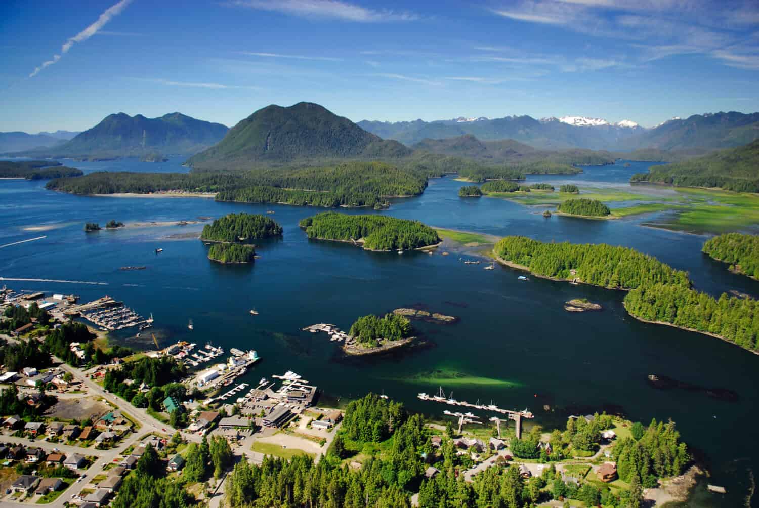
Tofino
Tofino is a charming little town with over 2,000 inhabitants. It is the perfect place to walk in the forest, stroll on the beach, take a surf lesson, or even hop on a seaplane or water taxi to discover the surroundings! Visitors can admire some of BC’s oldest and biggest trees on Meares Island. It is also a great spot to learn about the significance of this natural landscape to the Nuu-chah-nulth people.
And Tofino is a special place for wildlife. Spotting orcas, humpbacks, and grey or minke whales is very common. From April through October, Black bears can also be seen hunting for food along the shoreline.
4. Kootenay National Park Highway
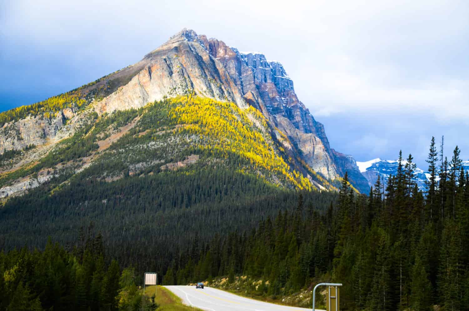
©Tatsuo Nakamura/Shutterstock.com
Also called Highway 93, the route winds through the heart of the Canadian Rockies in British Columbia. Starting at the southern end of Kootenay National Park, near Radium Hot Springs, this scenic highway is 58 miles (94 kilometers) long. It is a northward route, and its endpoint is at the Kootenay Crossing Visitor Centre.
The Kootenay National Park Highway offers stunning landscapes. Visitors can admire some of the Canadian Rockies’ most iconic mountains and the Kootenay River, with its beautiful crystal-clear, turquoise waters. Plus, if you visit in the summer, you can enjoy stunning wildflowers and, in the fall, vibrant foliage full of colors.
And the road is also home to various animals. Visitors can spot elk, deer, black bears, and even the occasional and elusive grizzly bear. Birdwatchers will also enjoy spotting multiple avian species.
Radium Hot Springs
The route begins in the charming town of Radium Hot Springs. While there, it is a great spot to soak in the Radium Hot Springs pools open year-round. It’s a perfect way to relax before your scenic drive.
Kootenay Valley Viewpoint
Along the highway, visitors come across the Kootenay Valley Viewpoint, which offers sweeping views of the Kootenay River valley. It’s a great spot to take a break and enjoy the breathtaking scenery.
Marble Canyon
A short hike from the highway, Marble Canyon is a geological wonder. The trail takes visitors over sturdy bridges and offers views of the deep, narrow canyon carved by Tokumm Creek through ancient limestone.
Paint Pots
Located at the end of a short trail, the Paint Pots are natural mineral springs with colorful ochre beds. It is a great place to take a stroll and observe how the vibrant hues contrast with the surrounding landscape.
Numa Falls
A short drive from the highway, Numa Falls is a must-see. The falls cascade over rock ledges and are easily accessible from the parking area.
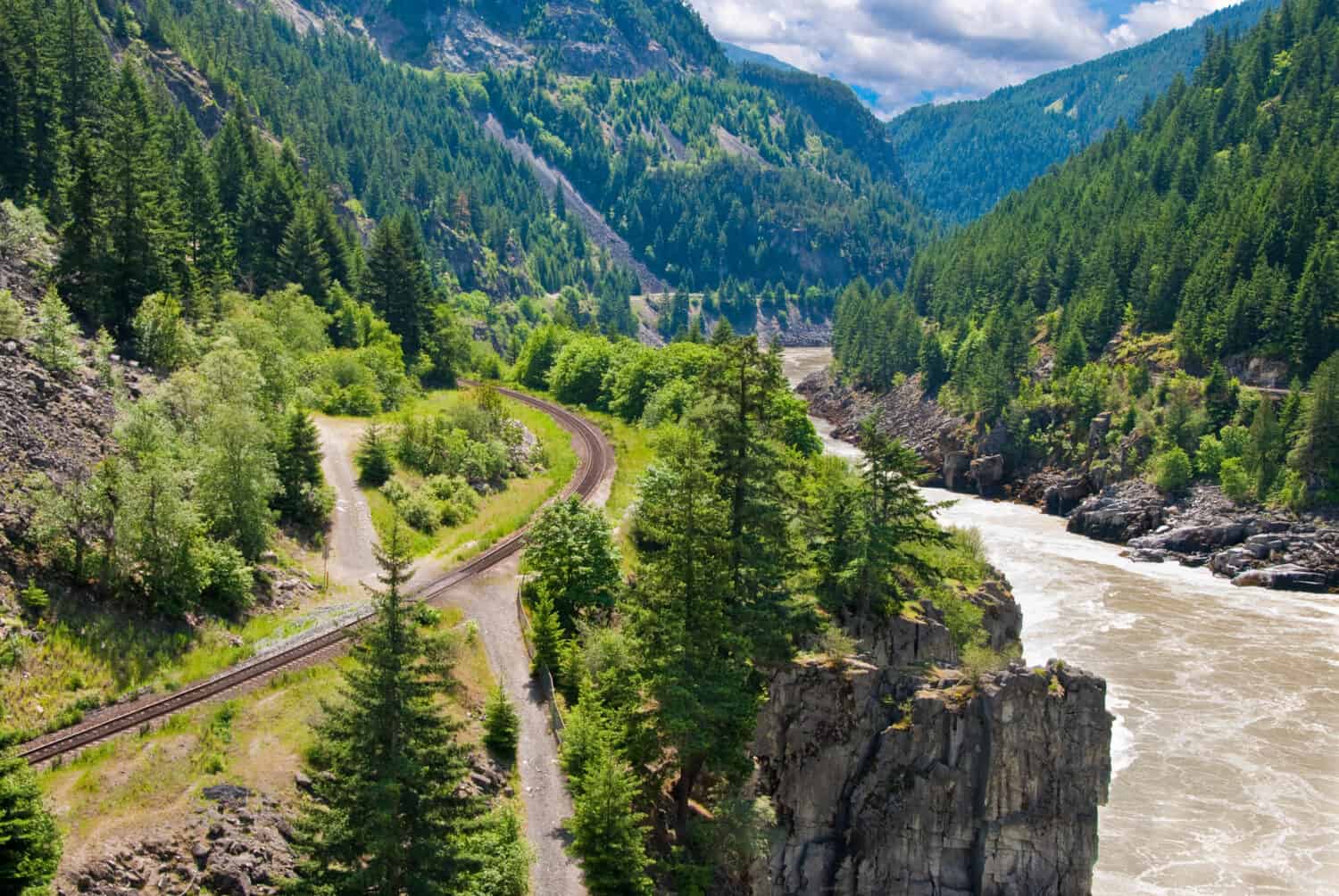
5. Cassiar Highway

©Pi-Lens/Shutterstock.com
Also known as Highway 37, Cassiar Highway is a remote and less-traveled route. It winds through the pristine wilderness of northern British Columbia for approximately 450 miles (724 kilometers).
Cassiar Highway starts in Canada’s Yukon Territory, at the junction with the Alaska Highway (Highway 1) near the town of Watson Lake. It continues southward to its southern terminus at the intersection with Highway 16 near the community of Kitwanga. This northern route provides a unique and off-the-beaten-path road trip experience. Visitors will be able to immerse themselves in the stunning landscapes and wilderness of northern British Columbia. Plus, they will avoid massive crowds and almost be alone on the route.
The Cassiar Highway is famous for its untouched wilderness and diverse landscapes. At the start, the route winds through extensive boreal forests dominated by spruce and pine trees. When going southward, lush greenery and forests surround the highway. The road is often surrounded by lush greenery. Along the way, numerous lakes, rivers, and streams are perfect for fishing, kayaking, and wildlife watching.
But forests and lakes are not the only highlights of the Cassiar Highway. The route crosses through large and rugged mountain ranges, featuring stunning vistas of snow-capped peaks and lush valleys. It is also the ideal spot to witness the wildlife. Black and grizzly bears, along with moose and other species, inhabit the area.
Jade City
Jade City, BC, is about 37 miles (60 kilometers) south of the Alaska Highway, BC. This unique little town is famous for its jade mining operations that gave its name. Visitors can explore jade shops, learn about the mining process, and even purchase jade souvenirs.
Boyds Lake Provincial Park
Boyds Lake Provincial Park, located about halfway along the Cassiar Highway, offers a serene spot for picnicking and camping. The clear waters of Boyds Lake provide an excellent opportunity for fishing and wildlife watching.
Stewart and Hyder
When driving close to the Cassiar Highway’s southern terminus, visitors can take a side trip to Stewart, a small town located on the border with Alaska, and cross into the United States into Hyder, AK. From there, visitors can hop on the Granduc Road and drive all the way up to the famous Salmon Glacier and its lookout. In the summer, it is possible to spot black bears catching salmon in Fish Creek during summer.
6. Cariboo Highway
©karamysh/Shutterstock.com
Cariboo Highway, also Highway 97 or the Cariboo Trail, is a historic and scenic route in British Columbia. Stretching approximately 521 miles (838 kilometers), this highway offers a journey through lush forests and rolling hills to serene lakes and charming towns. The route is also steeped in history, as it follows the path of gold rush prospectors during the Cariboo Gold Rush of the 1860s.
The landscapes along the Cariboo Highways change during the seasons, from wildflowers in the spring to vibrant foliage in the fall. Once leaving Cache Creek, the highway crosses rolling halls and ranchlands before transitioning into dense pine and spruce forests. Visitors should keep an eye open for black bears, deer, and moose, especially during dawn and dusk.
Highway 97 also passes by several lakes. These include Lac La Hache and the mighty Fraser River, where visitors can often spot wildlife like eagles and waterfowl. Along the way, many historical markers and interpretive signs tell the tale of the Cariboo Gold Rush and provide a glimpse into the region’s past.
Clinton
Clinton is a historic town that played a significant role during the Cariboo Gold Rush. Visitors can explore the Clinton Museum to learn about the area’s history.
Lac La Hache
Surrounded by forests, this picturesque lake is an excellent spot for fishing and water activities. Charming lakeside cabins are also available for visitors.
Williams Lake
Also known as the “City of the Lake,” Williams Lake is a hub for outdoor enthusiasts. The city offers opportunities for hiking and mountain biking. Visitors can also explore the local culture, for example, when attending the yearly Williams Lake Stampede (late June, early July)
Quesnel
Quesnel, a city rich in history, is home to historic sites, including the Quesnel Museum and the Pinnacles Provincial Park. It is the perfect place to take a stroll through the downtown area to admire the well-preserved heritage buildings.
Barkerville Historic Town
Another highlight of the Cariboo Highway is Barkerville, a well-preserved 19th-century gold rush town. Visitors can explore the historic streets and visit museums. Walking through Bakerville can sometimes feel like being in another century.
Summary of the 6 Most Stunningly Scenic Drives in British Columbia
| Rank | Route | Distance (miles) |
|---|---|---|
| 1 | Sea-to-Sky Highway (Highway 99) | 101 |
| 2 | Pacific Marine Circle Route | 185 |
| 3 | Vancouver to Tofino Route | 186 |
| 4 | Kootenay National Park Highway (Highway 93) | 58 |
| 5 | Cassiar Highway (Highway 37) | 450 |
| 6 | Cariboo Highway (Highway 97) | 521 |