Discover the 7 Largest and Most Important Bays in California
In its most fundamental definition, a bay is a recessed body of water surrounded by land connected to a lake, ocean, or another bay. Bays, however, are much more important than the dictionary makes them sound.
Along with providing essential diverse ecosystems for marine animals and wildlife, bays have historically served as hubs of shipping and trade and safe ports for sailors. Sometimes referred to as estuaries, these partially enclosed bodies of water remain vital to the shipping industry.
California is home to several important bays of various sizes. These include an especially renowned one where the best-known prison of the 20th Century is situated.
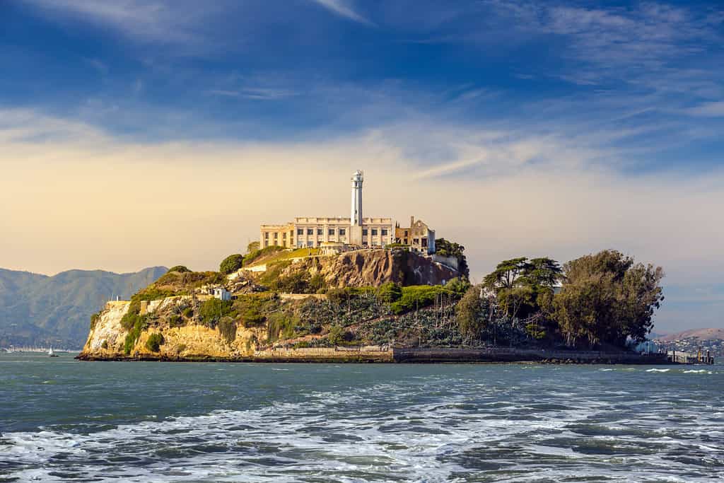
San Francisco Bay
©f11photo/Shutterstock.com
One of the world’s best-known bays, San Francisco Bay, is crossed by two iconic spans, the Golden Gate Bridge and San Francisco-Oakland Bay Bridge. It’s also the site of the legendary Alcatraz Federal Penitentiary. Known as “The Rock,” this nearly escape-proof island prison is now a major landmark and tourist attraction.
A flooded ancient river valley, the bay is 60 miles (97 kilometers) long and three to 12 miles (5 to 19 kilometers) wide. It encompasses an extensive urban area, including the city of San Francisco, as well as a number of other metropolises.
Oddly, this extensive bay was somehow overlooked by explorers and navigators until 1769. That was when it was discovered by a land expedition party led by Gaspar de Portola. Even famed British privateer Sir Francis Drake failed to find it after remaining in the area for six weeks in 1579.
Between 1849 and 1855, San Francisco Bay became the destination for many of the 300,000 ambitious souls who poured into California hoping to get rich during the “gold rush,” making San Francisco the world’s fastest-growing city for a time.
As large as it is, San Francisco Bay was considerably bigger until sediment from hydraulic mining began to fill in parts of it. That, along with the dumping of dredging spoils later on, reduced its size by about a third.
Humboldt Bay
©EWY Media/Shutterstock.com
On California’s northern coast is Humboldt Bay. This deep-water bay is 14 miles (22 kilometers) long and at its widest point 4.5 miles (7.24 kilometers) wide.
Despite being the second-largest natural bay in California, Humboldt Bay remained uncharted for centuries. Today, the top imports arriving in Humboldt Bay include forklifts and other heavy-duty construction equipment, along with cameras, and electric motors.
The bay’s most valuable resource, however, is the Humboldt Bay National Wildlife Refuge Complex. Overseen by the U.S. Fish and Wildlife Service, this refuge has been called one of the “most beautiful and biologically rich places in the world.”
The 4,000 acres that make up the refuge are protected areas that host over 200 species of birds. Some are just passing through while migrating along the Pacific flyway, while others use the area as a prime habitat. Humboldt Bay is also home to nearly 100 species of fish. November through March are the best times to see the rich and diverse wildlife that inhabit Humboldt Bay.
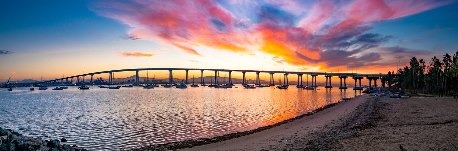
San Diego Bay
©Dancestrokes/Shutterstock.com
Considered the most exceptional deep-water harbor in the world, San Diego Bay is the third largest natural bay in California.
The bay is 12 miles (19 kilometers) long and from 1 to 3 miles (1.6 to 4.8 kilometers) wide.
San Diego Bay is famous for two, quite different, but equally important assets. One is the San Diego Bay National Wildlife Refuge. The bay serves as a habitat for a wide variety of endangered and migratory avian life. It covers over 2,600 acres of water and surrounding land, which contain coastal salt marshes and mudflat habitat.
Another vital feature of San Diego Bay is the Port of San Diego. Frequented by cruise and commercial fishing vessels the bay is known as the “cargo gateway to the Pacific.” The port handles around 2.5 million metric tons of cargo annually.
The Coronado Bridge, opening in 1969, crosses San Diego Bay linking the city of San Diego with Coronado. Between its western end and the Pacific is the peninsula of Point Loma.
Upon first viewing it in 1542, European explorer, Juan Rodriguez Cabrillo described San Diego Bay as a “very good, enclosed port.”
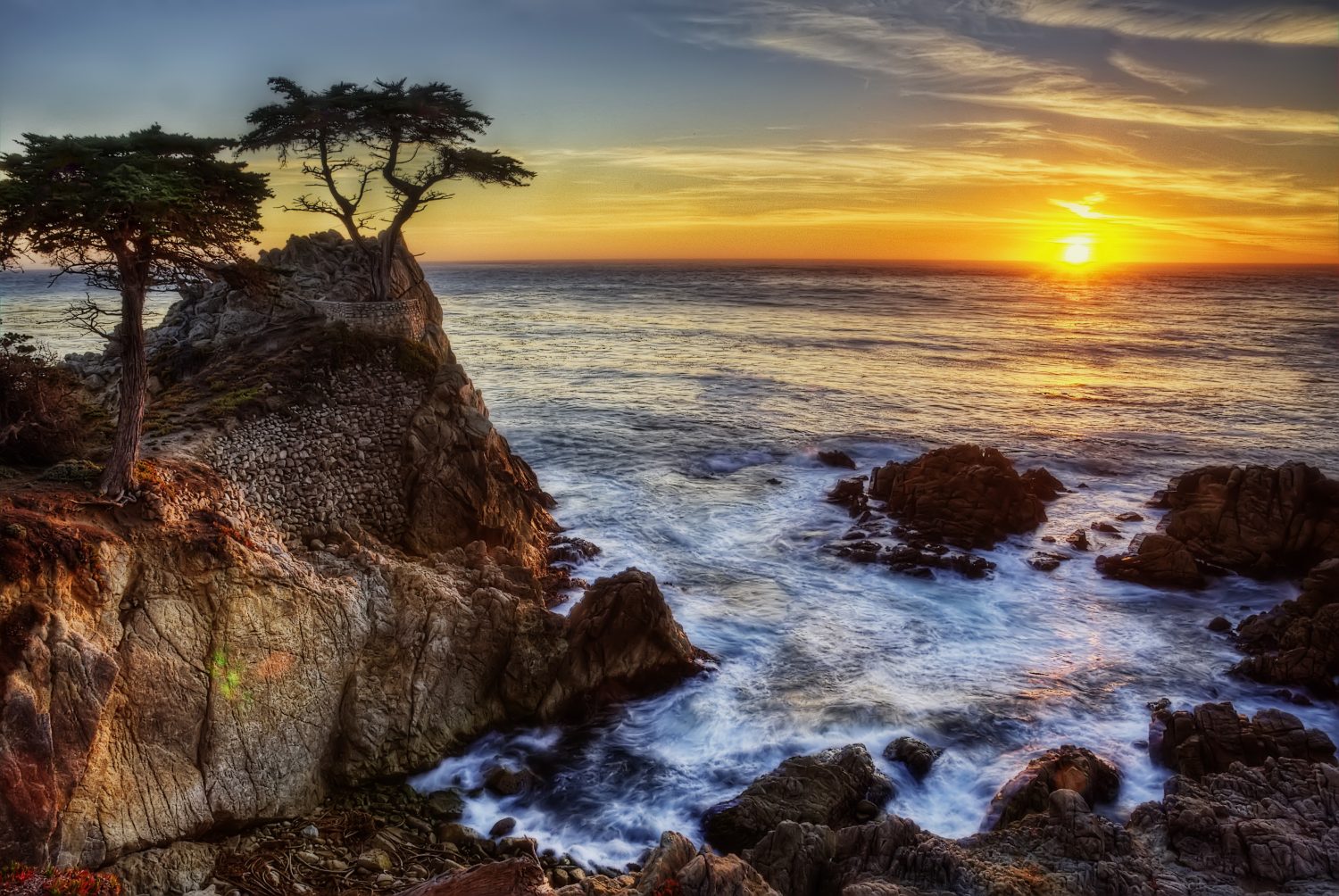
Monterey Bay
©Goldilock Project/Shutterstock.com
Monterey Bay forms a crescent-shaped indentation in the California coast south of San Francisco Bay. This scenic stretch of shoreline is especially favored by vacationers and sightseers. It is renowned for activities ranging from whale-watching tours to golf (including the famed course at Pebble Beach) to world-class culinary experiences.
The bay’s discovery by Europeans goes back to explorer Juan Rodriguez Cabrillo first sighting what later became known as the Point of Pines, or Point Pinos, in 1542. Some 60 years later, Sebastian Vizcaíno landed there while searching for a harbor for Spanish galleons and claimed California for Spain.
One of this bay’s most unique features is Monterey Canyon. The largest and deepest submarine canyon on the west coast, its shape is still evolving. Often compared in size to the Grand Canyon, it virtually bisects the bay.
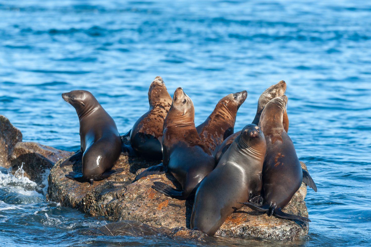
The bay is also known for its rich and diverse aquatic life, including some of the most wide-ranging species of marine mammals in the world. These include dolphins, porpoises, seals, otters, and large whales, including the most humongous animal on Earth, the blue whale. The best time to see blue whales in Monterey Bay is from June through October.
Cannery Row is another famous attraction at Monterey Bay. It was first established in 1927 to process sardines but closed down after 30 years when the small fish all but disappeared from the area. (They have since made a return.) Now, the locale has become both a protected national marine sanctuary and a booming destination. John Steinbeck immortalized it in his 1945 novel “Cannery Row.”
Modern day Cannery Row also features the world-famous Monterey Bay Aquarium, which specializes in the region’s marine life. Its exhibits include a living kelp forest and large-scale jellyfish exhibits.
Carmel Bay
©Lukas Bischoff Photograph/Shutterstock.com
Located in Monterey County, Carmel Bay is a unique coastal area four miles (6.4 kilometers) long and two miles (3.2 kilometers) wide. While its shoreline boasts some amazing, white-sand beaches, its true treasures are under water.
Managed by the California Department of Fish and Wildlife, the Carmel Bay State Marine Conservation Area runs between Pescadero Point and Point Lobos. Covering two miles of nearshore water in Carmel Bay, this area is a prime habitat for marine life.
The diverse marine environment contains kelp forests, surf grass, rocky reef areas, and a submarine canyon that goes to a depth of 470 feet. The bay is famous for its wide variety of fish, from flounder to striped seaperch to lingcod.
As Carmel Bay opens directly to the Pacific Ocean, it’s not uncommon to see gray and humpback whales during their migration. Other marine mammals common to Carmel Bay include sea lions and bottlenose dolphins.
This state marine protected area allows for the recreational take of finfish. However, the collection or possession of “any living, geological, or cultural marine resources” is prohibited.
Half Moon Bay
©Lu Yang/Shutterstock.com
Located 30 miles south of San Francisco, with a crescent-shaped shoreline that’s home to some outstanding beaches, Half Moon Bay is most famous for its monster waves.
The northern boundary of Half Moon Bay at Mavericks boasts the largest waves in all of North America. These waves commonly rise over 25 feet high. And during the right conditions, these massive swells can hit the 60-foot mark. In 1994 big wave surfer Mark Foo drowned there after a wipeout on a mere 15-footer.
These unusual waves are produced in part by a complex reef system that channels their energy. In a sonar project conducted in 2007 by researchers at California State University at Monterey Bay, maps of the ocean floor disclosed the presence of an underwater cliff or “ramp.” Before knowing exactly what it looked like, surfers had called the area their “launching pad.”
And as if surfing at Half Moon Bay isn’t risky enough, there are the occasional passers-by in the form of great white sharks. In the summer of 2023 a tagged 14-foot great white named Tough Guy pinged at Mavericks.
Water temperatures also pose a danger to swimmers and surfers at Half Moon Bay. Peaking at a chilly 60 degrees Fahrenheit (15.55 Celsius) during mid-August, they dip to around 45 degrees (7.2 Celsius) during the winter months, which are the peak surfing season.
Morro Bay
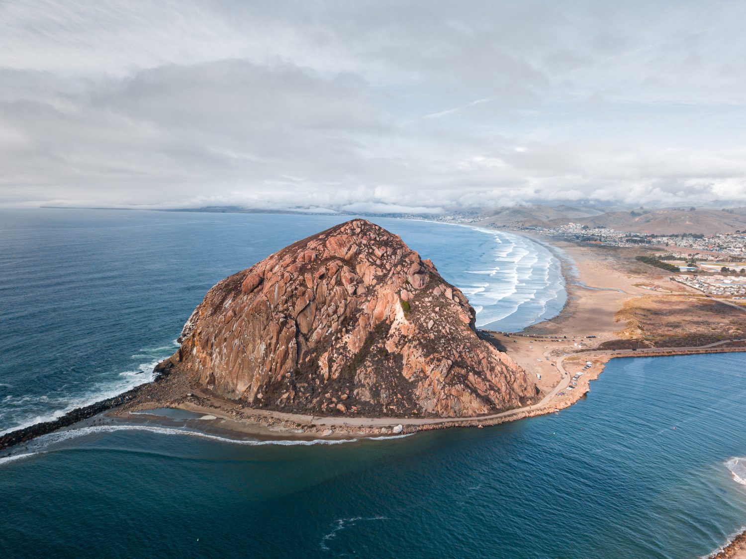
©Magargee Films/Shutterstock.com
Located in the county of San Luis Obispo, Morro Bay is a diverse wetland habitat consisting of a mix of fresh and saltwater. Protected from full exposure to the Pacific Ocean, this bay is managed by two state agencies.
The Morro Bay State Marine Reserve (SMR) and the Morro Bay State Marine Recreational Management Area (SMRMA) protect a four-mile area that includes tidal flats, eelgrass habitats, marshes, and three miles of beach area.
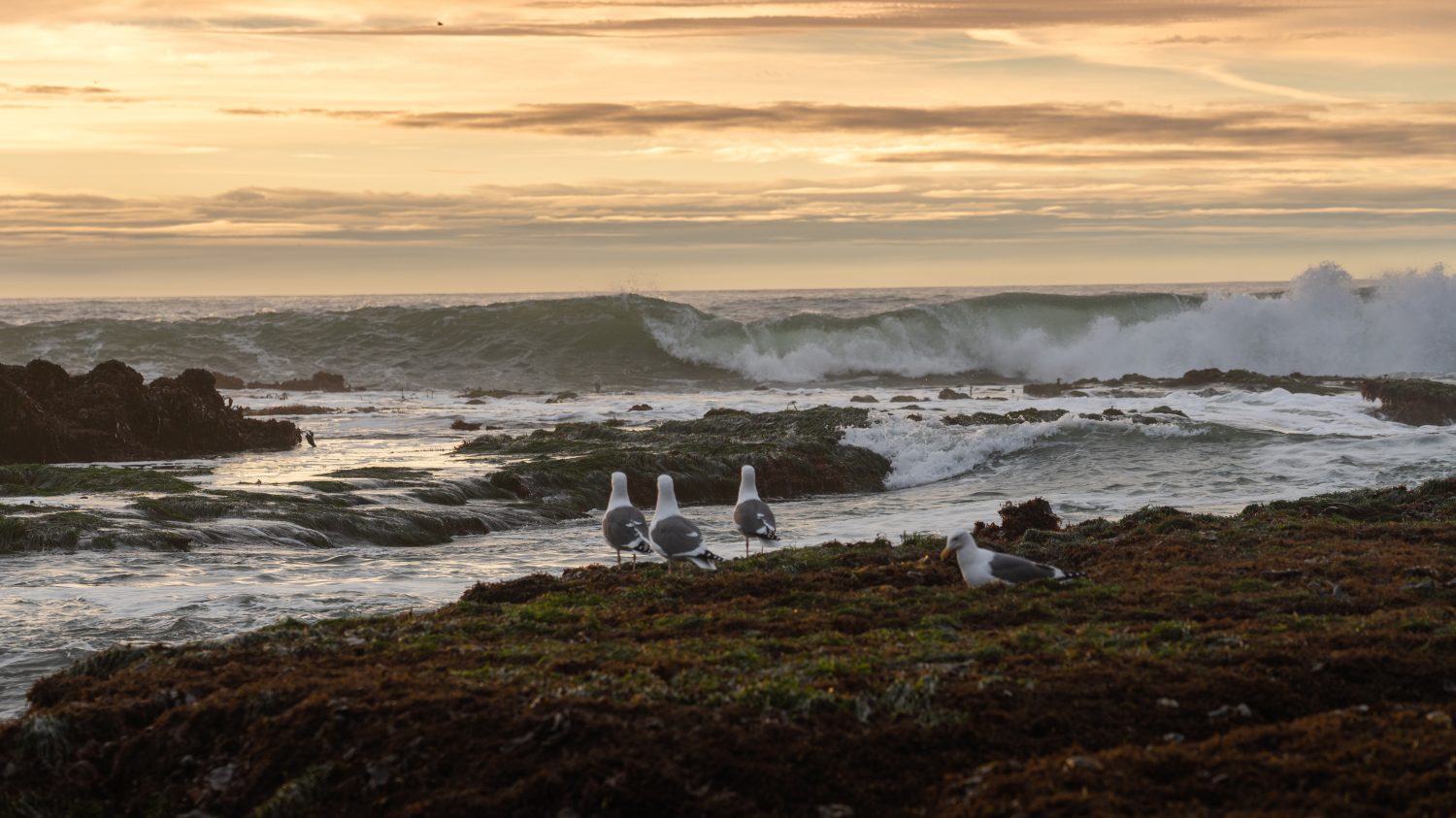
This bay attracts a diverse range of wildlife, especially birds, as it’s a stopover on the migratory route known as the Pacific Flyway.
Morro Bay’s mudflats host oysters, clams, shrimp, and crabs. The SMR- and SMRMA-protected eelgrass zone is a breeding ground for a variety of fish and invertebrates. Over a dozen threatened or endangered species of birds, amphibians, and invertebrates make their home here.
But the most famous, easily visible feature of the bay is Morro Rock. This historic landmark was created over 23 million years ago from the remains of an extinct volcano. Used for centuries as a navigation aid by mariners, Morro Rock is the most famous in a chain of ancient volcanic plugs in the region known as the Nine Sisters.
The Seven Most Important Bays in California
| Name of Bay | Features |
|---|---|
| San Francisco Bay | The largest Pacific bay in North and South America. |
| Humboldt Bay | The second-largest natural bay in California. |
| San Diego Bay | The third largest natural bay in California. |
| Monterey Bay | The deepest submarine canyon on the West Coast. |
| Carmel Bay | A diverse and unusual aquatic environment including a 470-foot-deep submarine canyon. |
| Half Moon Bay | Famous for its monster waves. |
| Morro Bay | An important wetlands habitat managed by two state agencies. |
The photo featured at the top of this post is © canadastock/Shutterstock.com


