Drawbridge: The Disappearing Ghost Town of the Bay Area
Every country has its ghost towns. Ghost towns help define the landscape of the past and tell us more about the way people lived – and died – before our time. Great cities lay underwater, small towns crumble in desolate areas, populations diminish as the railroads and highways of today leave the past behind. In California, one such town is slowly disappearing. Drawbridge, formerly known as Saline City, is a town that has been abandoned since 1979 and stands as a stark reminder of history that never made it. Not many people know about Drawbridge outside of California, and fewer people take interest in the slowly disappearing town. We’re going to explore it today, from its origins to its inevitable demise.
Where is Drawbridge?
Drawbridge rests six miles south of Fremont on Station Island. We’ve included an interactive map to show you the general area where the town used to exist. As you can see, you can’t really pin down the area as well as other towns. The green dotted lined underneath the Baylands outlines the area where the town used to be. You can zoom out to see that this spot is also north of San Jose and near Milpitas in the farthest southeast reaches of the Bay.
We also wanted to show you that you cannot access this area by car. You can drive down Cushing Parkway from Fremont to get close, but your car route would end near the Coyote Creek Lagoon Trail. You also aren’t allowed to access this site on foot. Since the town is now a part of the Don Edwards San Francisco Bay National Wildlife Refuge, it is protected and not open to the public. It is actually illegal to visit the town, and the San Francisco Bay Wildlife Society wants to let people know that it is actually unsafe to try to visit. We’ll talk more about this in a later section. Let’s look at the driving directions to the trail that would bring you closest to the old town. The trek from Fremont proper to this spot only takes about 14 minutes as you cross 6.9 miles.
Origins of Drawbridge
©yhelfman/iStock via Getty Images
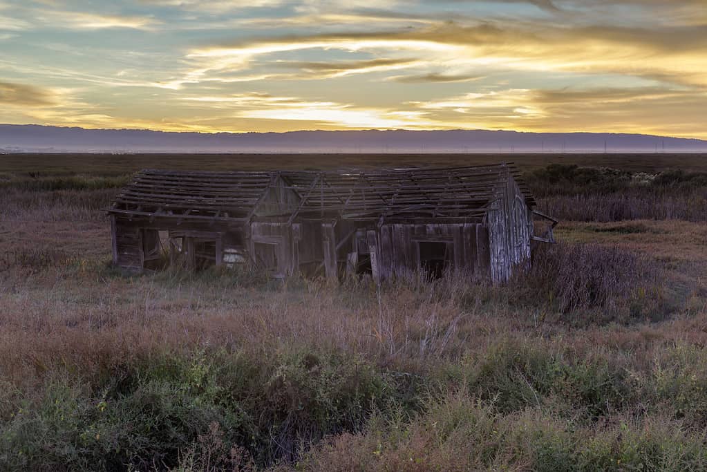
Drawbridge has origins similar to that of many other now-ghost towns. March 25th, 1876 spelled the beginnings of the town, when a San Francisco millionaire by the name of Alfred Davis teamed up with Senator James G. Fair to create the South Pacific Coast Railroad. This narrow gauge railroad was constructed with intentions to be competition against other railroads, such as Central Pacific and Southern Pacific. This dream would never come to pass, but the rail line was successful in its construction, running from Alameda to Santa Cruz. The line had a lot of interesting features on its route, including a ferry service from Dumbarton Point to San Francisco. Also of note was its course across a little marshy island that rested between Mud Slough and Coyote Creek.
This island was reached by two bridges, which were installed in 1876 along with much of the rest of the line. These were hand-operated bridges and allowed for the continuation of water traffic. Because they needed someone to tend the bridge, an employee was stationed on the island. This gave the island its first name – Station Island.
The island and surrounding area were ripe with hunting and fishing opportunities, and now people wanted to visit Station Island. The new railroad, which didn’t have an official stop at Station Island, now carried passengers to the area for these opportunities. Originally, all the visitors would sleep in the bridge tender’s cabin or in a baggage car, but popularity rose on Station Island and soon there were several cabins lining the marshy piece of land.
Is Drawbridge a Misnomer?
©DepthofField/iStock via Getty Images
Drawbridge is named for the two rail bridges that connect the island to the rest od the rail route – and the mainland. But is it appropriately named? Actually, no! According to a 2017 news piece by Jessica Placzek for KQED, the name “Drawbridge” is a misnomer. She interviewed Ceal Craig, the president of the San Francisco Bay Wildlife Society, who helped write a book about the incredible legacy of Drawbridge. Craig has an extensive knowledge of the history of this town and its creations. He says in the interview that the bridges built by the railroad company weren’t drawbridges at all – they were swim bridges!
When he speaks on the first resident of Drawbridge and his job there, Craig states that the town should have been named “Swing Bridge” and that George Mundershietz, the first operator of these manual bridges, would have actually been the first swing bridge operator. Mundershietz made a living as both a swing bridge operator and as a host – charging 50 cents a night to visitors who wanted to stop on the island.
The Rise and Fall of Drawbridge
Drawbridge became an unlikely destination for several different kinds of people, and the town would grow to host 80 or 90 homes, two hotels, and a number of hunting and gun clubs. The island isn’t big. It only stretches for about a mile into the marshlands, spanning around 80 acres. The population of the island was always changing – permanents residents were joined by hundreds of tourists and hunters on the weekends. Most of these hunters were out for ducks, and they would flock to the area to try their luck.
Allegedly, this wasn’t the only type of luck folks were seeking when they visited the island town. Drawbridge had no government or law enforcement, so it got a reputation as a popular destination for bootlegging, brothels, and gambling. However, former residents did discount these reports as quite the exaggeration, with accounts of a different sort of life dating back to 1900. Some remaining photographs show residents and tourists of the town as well-dressed and middle class, which may not save them from the rumors but does say something about the kinds of folks that were drawn to the area.
As duck hunting eradicated the ducks from the area, visits to the city grew fewer. This wasn’t the only reason for a decrease in the popularity of the island. Salt ponds and sewage dumps were created, and the local environment changed drastically. There were less hunting opportunities and more water pollution. Wells in Drawbridge tapped the water table and caused the most drastic change – the island began to sink into the marsh. This would spell doom for the already-dwindling population.
A Timeline of Drawbridge
©yhelfman/iStock via Getty Images
We have created this timeline to show dates of the most important events in chronological order. We got a lot of help from the San Francisco Bay Wildlife Society in building this timeline.
- 1876 – The drawbridges that give the town its name finish construction. Bridge-tender cabin erected.
- 1880 – Second cabin on the island constructed.
- 1880 – South Pacific Coast line #8 issues the first operating timetable, where the trains would stop at “Drawbridges” every Sunday.
- 1882 – Increased stops at Drawbridge for hunting and fishing opportunities.
- 1883 – First newspaper reference of Drawbridge and its “special trains” for duck hunters.
- 1890 – Many buildings – mostly hunting shacks but also hotels – are erected on the island.
- 1894 – Train line establishes regular Saturday night transits to Drawbridge. Sunday returns on the line become available. This implies opportunities for overnight stays.
- 1897 – The island is made an official station on the South Pacific Coast timetable.
- 1897 – The island is officially named “Drawbridge”.
- 1900 – Sprung’s Hotel officially opens.
- 1908 – Market hunting on the rise. Hunters devise ways to kill 500-1000 ducks in a single canon shot.
- 1920 – Salt companies build levees and begin to drain the marsh.
- 1926 – Drawbridge is highly popular, with upwards of 600 visitors every weekend.
- 1936 – Fresh water supply begins to decrease. Visitation to the island dwindles.
- 1940-1950 – Remaining residents subjected to horrific acts of vandalism, including looting and burning.
- 1963 – Less than five residents remain in Drawbridge.
- 1972 – Drawbridge is included in the San Francisco Bay National Wildlife Refuge as a part of a 23,000 acres acquisition.
- 1979 – The last resident of Drawbridge, Charlie Luce, leaves the island.
- 1980 – Drawbridge is officially a ghost town.
The Layout of Drawbridge
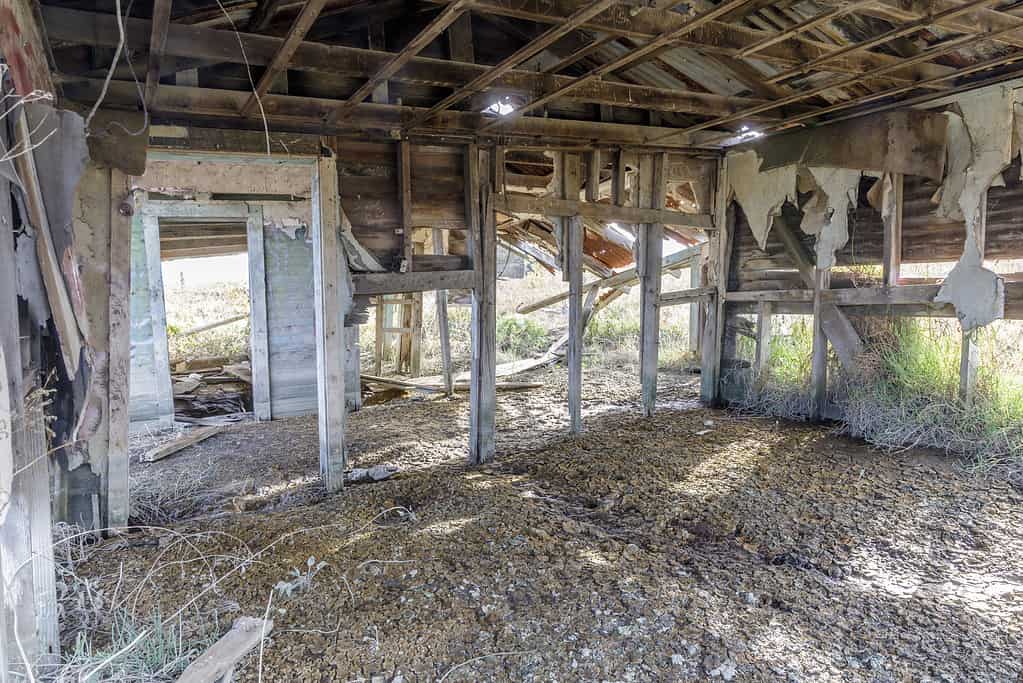
80 or 90 houses sprawled across the small island at its peak, many of them up on stilts and with rowboats to contend with the surrounding marsh. For a very short period of time, this was a bustling city, with a great influx of weekend visitors. There were many reasons for people to stop and visit, including hunting and recreation. There was even access to alcohol during Prohibition – Mrs. Sprung of Sprung hotel brewed her own dark beer and offered it for sale to hotel patrons!
Still, there was quite a class divide in Drawbridge. The town was divided into two areas, the north end and the south end. The north end was mostly set up for vacationers and visitors to the town. This was also where part-time residents would often live. The south end of the town was for full-time residents. This included full-time hunters and fishermen, along with the employees of the railroad and the local hotels. There was no school in Drawbridge, and children had to walk three miles down a railway track to get to school in Alviso, California.
This kind of divide is obvious in many towns and cities of modern America, but it is interesting to note that it can even happen in a place so small. Human culture seems to seek division between classes. It is not uncommon to see folks from several different walks of life having a hard time communicating with one another because of social and cultural differences across castes. Some experts even show proof that there are hidden rules for each social class. Not knowing them can make it hard to participate. This was increasingly clear in the booming years of this ghost town.
Why is Drawbridge Sinking?
There are several reasons for Drawbridge to be sinking into the surrounding marsh. First, we turn to the industrialization of nearby cities. Growing populations and fast changes in the way humans experienced the world caused some major problems. Industrial waste and human sewage had nowhere to go, and they were dumped into the bay. This was a huge pollution issue for the waters of the bay and the marshlands. Untreated sewage in large amounts deeply impacted the creeks surrounding Drawbridge.
In terms of industrial change, it wasn’t just waste being dumped. Salt manufacturing was booming in the South Bay, causing large companies to convert the marshlands into salt ponds. These salt ponds wreaked havoc on local wildlife, destroying necessary habitats for several bird species and changing the landscape of the marsh.
Next, the demand for water increased with the population of the area. Cities like San Jose needed more drinking water. When these cities tapped the aquifer, they drained the wells in Drawbridge. Empty wells meant empty space below the ground, and that space is now being filled – by the soil of the city as it sinks. No one knows when the town will ever be fully submerged in the marsh, or even if it will happen. But we do know that is is sinking now, and, one way or another, this piece of history will disappear.
Can I See Drawbridge?
©yhelfman/iStock via Getty Images
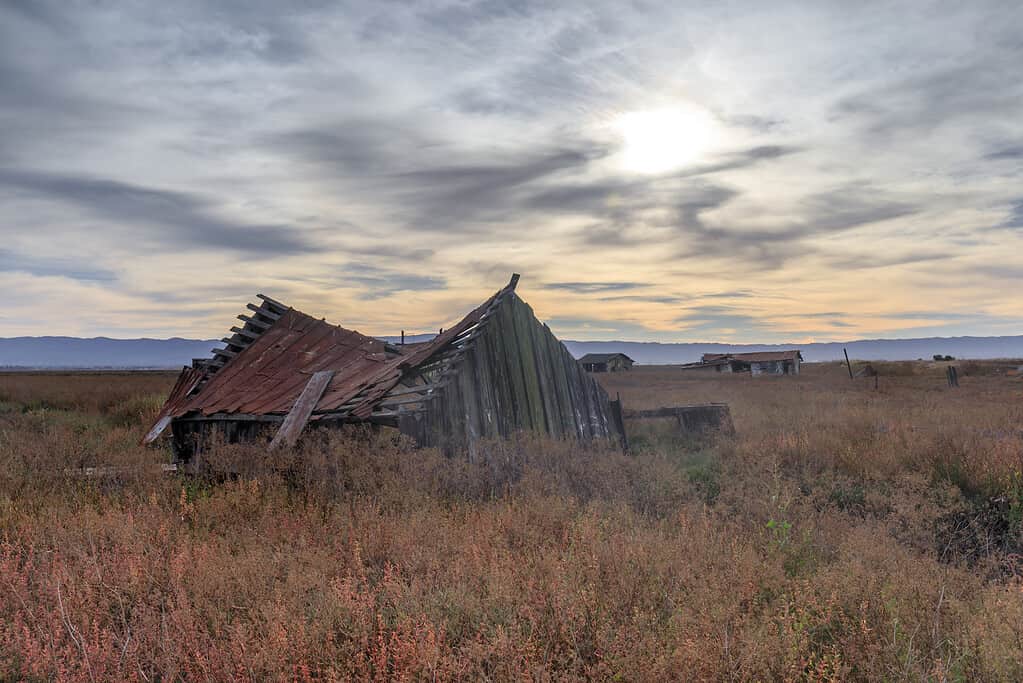
There is a safe and legal hike you can take to see Drawbridge from a distance. People who love the history of Drawbridge – or ghost towns in general – will delight in the view from the Mallard Slough Trail Spur vista point. This view showcases what’s left of the last ghost town in the Bay Area. The trailhead begins at the Environmental Education Center at the Don Edwards San Francisco Bay National Wildlife Refuge. The address to this center is:
1751 Grand Boulevard
Alviso, California 95002
The site is open from sunrise to sunset every day. Reaching the trailhead is pretty easy and can be accessed from the education center’s parking lot. You can choose to either walk through the butterfly garden or to take the New Chicago Marsh Trail to reach the Mallard Slough Trail. Once you get on the Mallard Slough Trail, you’ll hike about 1.5 miles. There’s a spur trail there that you will take another half a mile to get to the vista point. From this vista point, you can see the city of Drawbridge from across Coyote Creek.
The trail is able to be traversed on foot or by bicycle. It is a mostly flat trail that covers around 4.4 miles roundtrip. The average time it takes to hike it is 1.5 hours. The average biking time is 22 minutes. Make sure you visit during dry weather. After all, you’re trying to take a look at a ghost town that is sinking into marshlands! Wet weather makes the trails muddy and hard to traverse, so plan wisely before you make your journey to this awesome hike.
What Happened to the South Pacific Coast Railroad?
Just like the ghost town it created, the South Pacific Coast Railroad is also a ghost. The railway, which was started by humble strawberry growers in 1874, was completed by the new owner in 1880. The last passenger ride along the railway was only 60 years later on February 26th, 1940. The railway was the officially abandoned in June of the same year. Portions of the railroad remained open, such as the line from San Jose to Los Gatos. This served as commuter rail until it closed to passengers in 1955. From our research, we have observed that this portion of the rail did remain open for freight traffic until 1993.
Abandoned Rails has a lot more information about what became of the rest of this line. Overall, there are few remnants of what used to be – a railway with a dream that never fully came to fruition.
